This report from 1946 surveys the traffic in the Minneapolis Central Business District. It was a precursor to the construction of the interstate highway system.
The Ports and Waterways Section of the Minnesota Department of Transportation has prepared this terminal directory to provide information about Minnesota's Lake Superior terminals.
This directory includes information on the 43 terminals in Duluth-Superior, Two Harbors, Silver Bay, and Taconite Harbor. Information on Superior, Wisconsin terminals is included because Duluth and Superior share one harbor. Terminals are arranged in the directory by location in each harbor, beginning with those in Duluth proceeding to Superior and then moving north along Minnesota's North Shore to Two Harbors, Silver Bay, and Taconite Harbor. The index presents an alphabetic listing of the terminals. Information for each terminal includes cargo handled, pier length, depth along dock, storage, equipment, rail-truck access, and the name of a contact person.
Information included in this directory was obtained from terminal operators and the Seaway Port Authority of Duluth. The photographs of the terminals in Two Harbors, Silver Bay, and Taconite Harbor were obtained from the Canal Park Marine Museum in Duluth.
This report consists of the presentation and analysis of traffic volumes recorded in 1973 at locations in the seven county metropolitan area of the State of Minnesota. Traffic volumes at these locations are recorded on a continuous basis through means of fixed type automatic traffic recorders.
In 1999, the Statewide Transportation Tracking Study was conducted by the University of Minnesota Center for Survey Research during the months of February, March, and April. However, to determine changes due to seasonality, certain questions were repeated for the fall 1999 survey conducted during the months of September, October, and November. This study is part of the Minnesota State Survey, a statewide omnibus survey which includes questions about a variety of topics.
A total of 802 telephone interviews were completed with an overall response rate of 52%. The cooperation rate of the interviews was 61%, a five percent increase from the spring 1999 survey. The sample for this study consisted of randomly selected households from all Minnesota telephone exchanges. Every household with a telephone in the state had an equal chance to be included in the survey, as did every adult member within a household. This sampling design is identical to that used for previous Minnesota State
Surveys.
Contributors to this year's transportation questions were: the Measurement and Evaluation Section of the Management and Data Services Office and the Office of Advanced Transportation Systems. The questions have been grouped into four sections: transportation, telecommuting, technology, and comparisons between residents of the Twin Cities Metropolitan Area and Greater Minnesota. Customer satisfaction trends are shown, where appropriate, at the end of each section.
The Minnesota Highway Department has adopted objectives to expand its efforts to inform and involve the public in the highway planning process. This article addresses the topic of citizen involvement in the project development process and the implementation of efforts to achieve the Department's objectives.
The content of this article is based on a literature review, the results of workshops and conferences, the recommendations of the Citizens Action Plan Task Force and previous citizen involvement experiences. The content does not reflect official policy of the Minnesota Highway Department nor does it represent a specification or regulation.
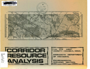
This study surveys the resources in a rectangular area 3 miles east, 4 1/2 west and 3 1/2 miles north of Chaska, Minnesota. The study was intended to aid in the selection of alternate routes and the preparation of an Environmental impact Statement for TH 212.
The extension of 1-35 around Duluth's downtown area must be undertaken in a manner which minimizes the adverse impacts of the highway facility and at the same time maximizes social and physical objectives formulated by the City. This study, undertaken by the City of Duluth, defines ten multiple use projects needed to minimize adverse impacts and achieve local objectives.
Consistent with the provisions of the Federal-Aid Highway Program Manual (FHPM) 7-7-8 (PPM 90-5), this multiple use and joint corridor study analyzes and evaluates localized impacts of the freeway extension and provides recommendations regarding future physical, social and economic patterns. It includes project costs, a financial plan, and a schedule of actions to establish financial participation by various public and private entities and a time-frame in which these improvements should be provided.
This joint development study is a continuation of the Duluth Corridor Study, an interdisciplinary study for the location and design of the transportation facility, undertaken by the firm of Eckbo, Dean, Austin and Williams in 1972. Many of the multiple use projects now being studied are a direct result of concepts presented in this earlier report.
The purpose of the I-35W Urban Corridor Demonstration Project is to implement and evaluate the Bus-on-Metered Freeway
System. The system concept includes the following elements:
-metering of an urban radial freeway
- a real-time surveillance, command and control system
- extensive express bus service in the corridor
- priority access to the freeway via exclusive bus ramps
- provision of transit passenger amenities, i.e., bus shelters, signs, and park-ride facilities in the corridor
Planning the project was completed in September of 1971 and the complete Bus-on-Metered Freeway System was operational on April 9, 1974. Express bus service was begun on a "step-start" basis in the fall of 1971; the vast majority of the express bus service
was initiated on December 11, 1972.
The recommendation of this report is to proceed with development of the Bus-Metered Freeway System in the I-35W Corridor. Analysis of the concept, the engineering detail, the operations, and the cost indicates the feasibility of combining a freeway surveillance and control system (a proven concept) and freeway express bus system (a proven concept).