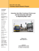
Transitways such as light rail transit (LRT) and bus rapid transit (BRT) provide fast, reliable, and high-capacity transit service. Transitways have the potential to attract more riders and take a portion of the auto mode share, reducing the growth of auto traffic. Park-and-ride (PNR) facilities can complement transit service by providing a viable choice for residents who are without walking access to transit or those who prefer better transit service such as LRT or BRT. In this study, we conducted two research tasks on Transitways services in the Twin Cities region in Minnesota; 1) to examine the impact of the operation of the Green Line LRT on the annual average daily traffic (AADT) of its adjacent roads, and 2) to estimate a PNR location choice model in the Twin Cities metropolitan area.
The objective of this research was to measure the benefits of rural and small urban transit services in Minnesota. The study accomplished this by first identifying; describing; and classifying the potential benefits of transit. Second; a method was developed for measuring these benefits. Where possible; benefits were quantified in dollar values. Other benefits that could not be monetized were either quantified in another way or described qualitatively. The study included an analysis of societal benefits and economic impacts within local communities. Third; the developed method was applied to a series of six case studies across Greater Minnesota. Data were collected through onboard rider surveys for each of the six transit agencies. Total benefits and benefit-cost ratios were estimated for the six transit agencies--all showed benefits that exceeded costs--and results were generalized to Greater Minnesota. Finally; a spreadsheet tool was developed that can be used by any transit agency to calculate the benefits of its services. This research provides information to assess the benefits of public spending on transit; which gives decision makers the data needed to inform investment decisions.
This research presents a series of accessibility methodologies developed for bus-highway system interactions. Accessibility is defined as the collective number of jobs that can be reached by a particular mode of transportation within a given travel time period. The effects of managed lanes (ML); park-and-ride (PNR); and travel costs on walk-up transit accessibility are measured for the Minneapolis-Saint Paul (Twin Cities) region. Each methodology is introduced; supported by a literature review; and described in detail before scenario results are presented. The final analysis uses the ML and PNR methodologies to establish a comprehensive transit accessibility profile for the Twin Cities; which accounts for the dual impact of auxiliary transportation facilities.
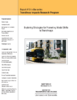
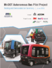
To better prepare for the operations of an automated shuttle bus in mixed general traffic and in Minnesota cold weather climate conditions; MnDOT is conducting an Autonomous Bus Pilot project. The purpose of the proposed Minnesota Autonomous Bus Pilot project is to define an automated vehicle pilot and solicit technology partners to come to Minnesota to work with the stakeholders in safely demonstrating the technology.
Transitways represent large public investments whose positive impacts must be maximized whenever possible to justify the expenditures they entail. Prominent among those looked-for positive impacts is the encouragement of automobile-to-transit mode shifts by attracting increased transitway ridership. This study explores the impacts of travel time, travel cost, and population density on mode choice, using the 2010 Travel Behavior Inventory. We found a monetary value of in-vehicle travel time of $17.5/hour and a transfer penalty of $10, equivalent to 35 minutes in-vehicle travel time. Density, especially at destinations, has important effects, but travel time is the key to promote the shift to transit. The research also employs a Direct Ridership Model (DRM) to predict boardings at the station level as a function of transit-supportive policies. We find that station-area focused policies promoting affordable housing and sidewalks on all streets in station areas or entire cities have a significant and positive impact on ridership if there are sufficient potential destinations in the immediate station area, measured as the number of Google places within 100 meters. Based on our results, we stress the importance of station area affordable housing as a transit system efficiency measure, as well as for the social equity reasons it is usually encouraged. We recommend strengthening pro-affordable housing policies and pro-sidewalk policies in Twin Cities station areas, supporting and encouraging for the neighborhood-scale commercial development that is required for their efficacy, and the continued implementation of pro-affordable housing policies and pro-sidewalk policies as the regional transitway system expands.
Long-term, regional travel demand models are essential tools used by planning organizations for resource management, project scheduling, and impact studies. Developed primarily at the macroscopic level, these tools lack sufficient detail to capture the influence of local geometry, dynamic traffic controls, or advanced transportation demand management (ATDM) strategies. To bridge the gap, a hybrid mesoscopic-microscopic model was developed. The core of the model, surrounding two light rail corridors in Minneapolis-Saint Paul, Minnesota, was developed at high resolution for microscopic simulation to capture the interaction between traffic signals, transit systems, and the road network. The remainder of the greater Twin Cities area was implemented based on the Regional Planning Model (RPM) maintained by the Metropolitan Council. Interfacing the Aimsun-based hybrid model with the Cube-based RPM, the Twin Cities Metro Hybrid Simulation was used to iteratively improve mode choice and traffic assignment to achieve a dynamic user equilibrium state. Important lessons were learned regarding the effort required to develop and maintain such a model with implications for future large scale regional modelling.
Human beings are creatures of habit. Traveling patterns are routines that we repeat over and over until something disrupts those patterns. When disruption occurs, there is an opportunity to entice travelers into new travel patterns. Surveys found that the highway construction in Duluth disrupted travel patterns for 40% of persons surveyed. During the Duluth Megaproject highway construction project, the Minnesota Department of Transportation (MnDOT) and the Duluth Transit Authority (DTA) used the opportunity entice travelers to transit. Additional trips and park and rides were added, which made transit more attractive to more travelers. Also, dedicated bus lanes were added to reduce travel time. Free fares enticed travelers to transit. A large promotional effort was undertaken to let travelers know about these enhanced options. Surveys of transit riders found that all of these efforts helped attract riders to transit. Surveys also looked at what factors were important for keeping riders on transit after highway construction ended. Once new habits are formed, it is likely travelers continue those habits until another event forces them to examine their travel patterns. This research found less than 15% of transit riders changed their behavior within two years and all did due to life changes, primarily job change or finishing school. It appears that once travelers change to transit, riders continue to use transit as long as it is a reasonable option. Increasing fares to normal levels did not create a significant incentive to stop using transit.
This report discusses the potential benefits and perceived impediments to implementing an automated rapid transit (ART) system in the Twin Cities and Minnesota. The report also briefly reviews the status of ART applications, also referred to as personal rapid transit (PRT), in the United States and abroad. Finally, the report evaluates the potential ability of ART to promote the policy goal of creating efficient development, livable communities, and work opportunities through a variety of relevant strategies. The report concludes that an ART feasibility study is needed to provide more definitive answers to issues and questions raised about ART, and it provides the rationale for funding such a study, as well as an outline of the elements of the feasibility analysis.
This research project investigates the status of personal rapid transit (PRT) applications in airport environments, to understand the characteristics and attributes of these systems, to explore the viability of a PRT system in the Minneapolis-St. Paul International Airport, and to prepare a synthesis report and presentation that document the project's findings.
Report #9 in the series: Access to Destinations Study. Conventional transportation planning is often focused on improving movement (or mobility) - most often by the automobile. To the extent that accessibility, a well-known concept in the transportation planning field since the 1950s, has been measured or used in transportation planning, such measures have also been auto-based. Broadening the scope of accessibility to include a wide array of destinations and non-auto modes such as walking, cycling, and transit has been previously proposed as a much needed aim among planning initiatives. A central issue is that to date, however, there have been few examples of measures draw from. When it comes to bicycling, walking, and transit measures of accessibility are an endeavor long on rhetoric but short on execution. This report discusses such hurdles, presents alternatives for overcoming them, and demonstrates how accessibility for walking, cycling, and transit - and for different types of destinations - can be reliably measured. We focus on explaining specific features of non-motorized transportation that complicate the development of accessibility measures, and offer solutions that conform to conventional transportation planning practice. In this research project, non-motorized measures of accessibility were developed for the entire seven counties of the Twin Cities (Minnesota, USA) metropolitan area. For purposes of this exposition in this report, we discuss the details of creating such measures using a sample application from Minneapolis, Minnesota, USA to demonstrate proof of concept for the endeavor.