Project Summary: Real-Time Integration of Arrow Board Messages into Traveler Information Systems

Image
Date Created
2024-11
Description
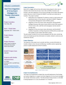
Many DOTs struggle with real-time information being relayed to their users in situations that involve lane closures. Due to the variability in location and duration, real-time integration of arrow board messages into traveler information systems became an item of interest for MnDOT to provide up-to-date data to travelers. This project involved: • Deployment of an integrated ITS solution to report on the location and operational status of arrow boards in real time to MnDOT's Regional Transportation Management Center (RTMC) systems. • Integration of the arrow board status information with the MnDOT Intelligent Roadway Information System (IRIS) to alert RTMC operators of lane closures who could then add messaging to nearby dynamic message signs. • Integration of the arrow board status information with the MnDOT Condition Acquisition and Reporting System (CARS) which provided real-time updates to the traveler information system. The pilot project involved 20 arrow boards equipped with the status monitoring unit to test displaying real-time information to travelers related to stationary and mobile lane closures.

Project Summary: Variable Pedestrian Clearance Interval (VPCI)

Image
Date Created
2024-11
Description
The Variable Pedestrian Clearance Interval (VPCI) project consisted of deploying, testing, and analyzing the results of installing video at an intersection to extend the Flashing Don't Walk (FDW) interval as needed when pedestrians were still located within the crosswalk. To complete this project, the project team: • Installed pedestrian detection equipment. • Reviewed an initial round of testing data to find gaps in the system data. • Determined a new path forward after identifying the data gaps. • Tested additional pedestrian detection equipment. • Utilized ATSPM data to verify the outcome of the pilot.

Assessment of Pedestrian Safety and Driver Behavior Near an Automated Vehicle

Image
Date Created
2024-01
Report Number
2024-02
Description
As more automated vehicles enter shared roadways, an essential aspect of automated vehicle (AV) safety is understanding the interactions between these vehicles and other road users. Anecdotal incidents about aggressive following and overtaking behaviors at crosswalks near the Med City Mover (MCM), a low-speed automated shuttle (LSAV) pilot demonstration in Rochester, MN, suggested the need for a scientific study of the behaviors of drivers of manual vehicles near the LSAV. In this report, the research team conducted a series of laboratory and field studies aimed at better understanding the safety relationship between LSAVs and the humans with whom they share the road. Overall, the studies found an increased risk of overtaking and multiple threat passing near the MCM, which may increase the risk of pedestrian-involved crashes, sideswipe crashes, and rear-end crashes. Study findings suggested that poor human-machine interfaces, exceptionally slow vehicle speeds, and resultant large queues behind the MCM contribute to these risks. Improved communication interfaces, speeds more consistent with the surrounding traffic, and smaller queue size will be important factors that AV developers and future pilot demonstrations must consider to better promote pedestrian safety near AVs.

Rural Pedestrian Crossing

Image
Date Created
2024-12
Report Number
2025RIC01
Description
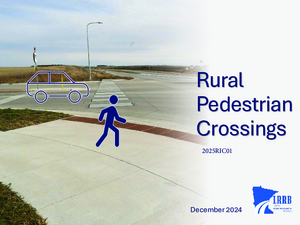
This research project summarizes various aspects of pedestrian crossings. The document is focused on pedestrian crossings in a rural environment. This project seeks to provide a comprehensive overview of pedestrian crossings for both pedestrians and drivers by examining Minnesota statutes, summarizing key features of pedestrian crossings, synthesizing findings from existing research reports and studies, and integrating other relevant resources.

Implementation of Inductive Loop Signature Technology for Vehicle Classification Counts

Image
Date Created
2024-12
Report Number
2024-29
Description
This study evaluates recent technology that uses inductive loop detectors, traditionally used for collecting traffic volume and speed data, to provide vehicle classification data by examining the high-resolution signature produced when a vehicle passes over the sensor. The project aims to verify the accuracy of the new classification system, collect additional heavy vehicle data to help improve system accuracy, and familiarize MnDOT staff with the technology through training and the development of a field deployment manual. Through collaboration with MnDOT and the technology vendor CLR Analytics, Inc., the VSign vehicle classification system has been installed at five sites in Minnesota with preexisting loop detection systems. The final sites are representative of MnDOT facilities, feature a mix of heavy vehicle traffic, and provide accessibility for deployment staff. Data from the VSign system was compared with manually verified ground-truth data collected from video under both the Federal Highway Administration (FHWA) and Highway Performance Monitoring System (HPMS) classification schemes. The system demonstrated high accuracy for passenger vehicles but varying accuracy for different classes of heavy vehicles, though performance improved under the HPMS classification scheme. The VSign system was also evaluated against the video-based iTHEIA™ system at one site, which VSign outperformed in both classification accuracy and detection rate. The results suggested that the VSign system was more effective at locations where vehicles maintained consistent speeds and were centered in the lane due to the negative effects of variations in speed and lateral position on the consistency of vehicle signatures read by the detector.

Pedestrian Safety and Accessibility Best Practices for Channelized Right-Turn Lanes

Image
Date Created
2024-12
Report Number
2024-31
Description
This research sought to identify best practices for channelized right-turn lanes (CRT) that better accommodate the safety and accessibility needs of all road users. This was accomplished through a comprehensive literature review, a state-of-the-practice survey of state and local roadway agencies (nationwide and within Minnesota), a review of agency policy and guidance materials (nationwide and MnDOT), and a series of focus group meetings focused on vulnerable road users. Feedback received both from the survey of transportation agencies and the focus group sessions performed as a part of this research suggest that roadway agencies throughout the United States are moving toward proactive policies for the use of CRTs that emphasize safety and mobility for vulnerable road users. This movement is generally based on the concerns for the safety of vulnerable road users outlined in the prior section and commonly includes 1.) minimizing the use of CRTs at urban and suburban intersections and/or 2.) designing new CRT facilities or retrofitting existing facilities with mitigation strategies to improve the safety and accessibility for vulnerable road users. This information was synthesized along with the best practices found in the research literature and agency policy/guidance materials to develop implementation guidance, which is organized within the report as follows: 1.) guidance for use of CRTs based on the project scenario; 2.) traffic control recommendations for CRTs; 3.) recommended design features for CRTs; and 4.) recommended mitigation strategies intended to improve CRT safety and/or accessibility for vulnerable road users.