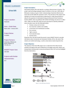
Automated vehicles (AVs) rely heavily on roadway infrastructure to function. This project used technology-equipped research vehicles to drive over 1,000 miles of Minnesota roadways to gain a better understanding of potential infrastructure issues that would inhibit the operations of AVs. The outcomes of this project were intended to be used by transportation professionals to make improvements to allow for the operation of automated driving and Advanced Driver Assistance Systems (ADAS). Data was gathered with vehicle technology and sensors to collect radar, LiDAR, and video data which was post-processed to identify problematic areas and place issues into the following buckets:
• Freeway ramps and turn lanes.
• Poor lane line condition and visibility.
• Construction and maintenance activities.
• Poor contrast.
• Tight curvature.
• Environmental issues.
• Dynamic lanes.
Along the drive, the team hosted live events in every MnDOT district to provide information about Connected and Automated Vehicles (CAVs), the state of the industry and vehicle technology, as well as observations made along the drive.
The Condition Acquisition and Reporting System (CARS) eXchange project was put in place to support the FHWA's goal of increasing safety for the traveling public by sharing real-time work zone information between the public and private sectors, under an FHWA grant. To do so, MnDOT planned to advance work zone reporting, safety, and mobility by:
• Pushing information to third parties in the WZDx format: WZDx Publisher
• Pulling information from other WZDx-compliant feeds: WZDx Fusion Engine
• Creating a mobile tool for workers to check into work zones: Work Zone / Worker Presence (WZWP) App
The Smart Snelling project was comprised of two main components:
• Testing a third-party application to provide users signal phasing and timing (SPaT) information.
• Testing snowplow signal priority.
MnDOT and Ramsey County installed connected vehicle technology equipment at 16 intersections owned by MnDOT and Ramsey County. The project tested the equipment’s ability to provide snowplow signal priority by communicating with the onboard unit on the plow truck. The project also tested the “TravelSafely” mobile phone application’s capabilities to provide real-time information accurately and effectively about signal phasing and timing to inform travelers of phase changes, red-light running, and presence of pedestrians/cyclists.
The Rochester Automated Shuttle Pilot was a research project that included the 12-month demonstration (August 2021 - August 2022) of two highly automated and electric vehicles to over 3,000 passengers along a fixed route downtown in the City of Rochester. The circular, fixed route connected the Mayo Clinic downtown campus with residential neighborhoods, shops, restaurants, grocery stores, hotels, and parking lots to serve the residents and visitors of Rochester. Each shuttle had a 6-person capacity with operating speeds of 12-15 mph.
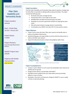
The Fiber Optic Feasibility and Partnership Study aimed to develop a strategic plan for future fiber connectivity by utilizing public-private partnerships. The project involved the following tasks:
• Reviewed state policy and legal barriers.
• Assessed the state's current right-of-way assets.
• Identified fiber and telecommunications gaps and needs.
• Developed an economic opportunity valuation by mapping the state's assets.
• Met with private industry to gauge interest in partnerships.
• Coordinated across MnDOT and other DOTs for best practice reviews.
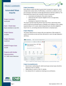
Waze offered a traffic data feed to government transportation agencies, which included alerts (citizen alerts of traffic delays, construction, accidents, etc.) and jams (slowdown information created algorithmically by the Waze platform). The Automated Waze Imports task consisted of several components:
• Customized and deployed a Waze alerts importer.
• Enhanced the alerts importer eligible for the 511 Google delay
measurements.
• Developed an importer for Waze Jams.
The project involved importing all alert types from Waze, determining which events should be documented based on reliability and confidence scores, adding expected delays to 511 events, determining which jams should be eligible for import into 511, and adding directional information to displayed jams.
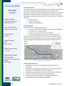
The Connected Corridor was a foundational Connected Vehicle (CV) project along TH-55 that included planning, design, deployment, and operation of CV technologies to create a better understanding of what is required for planning and preparing for emerging transportation technologies. This initiative showcased technologies to improve the safety and efficiency of the travelers on the roadway including:
• Software systems.
• Roadside infrastructure.
• On-board vehicle equipment.
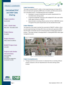
The project assessed MnDOT’s ability to share signal phasing and timing (SPaT) data and intersection geometry (MAP) data to travelers and third-party systems via a centralized process. The following tasks were completed:
• Developed a concept of operations and systems requirements for a centralized data sharing system.
• Conducted stakeholder interviews with multiple DOTs that used similar traffic signal software as MnDOT.
• Demonstrated an existing software product (Q-Free's MAXVIEW version 2.X) against the system requirements and documented the results.
The MnDOT Autonomous Bus Pilot project consisted of deploying a Level 4 shuttle provided by EasyMile on the MnROAD facility. The bus was used for several rounds of public demonstrations as well as testing at the MnROAD facility during winter conditions. The bus could hold up to 12 people and had a range of typical driving speeds from 2 to 11 miles per hour. Demonstrations were conducted in various winter conditions with several variables.
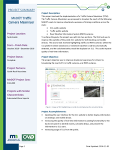
This project involved the implementation of a Traffic Camera Maximizer (TCM).The Traffic Camera Maximizer was proposed to broaden the reach of the following MnDOT assets to improve situational awareness of driving conditions across the state:
• 511 public website
• Traffic public website
• Road Weather Information System (RWIS) cameras
To achieve the goals, the project was split into two portions. The first task was to improve the usability of the public 511 website for both desktop and mobile devices. The second task involved highlighting traffic and RWIS cameras within the 511 platform where slowdowns or inclement weather could be automatically detected, and the calculated delay would be displayed on 511. This could improve quality of real-time information.