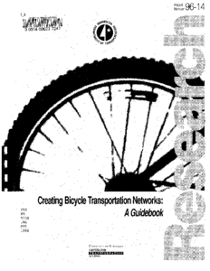
Creating Bicycle Transportation Networks: A Guidebook

Image
Date Created
1996-07
Report Number
96-14
Description
This guide presents a practical planning model for bicycle transportation in cities, suburbs and small towns. It focuses on the use of networks of specialized bicycle facilities and bicycle friendly zones to support and promote the use of bicycles for transportation. The potential of using bicycle roadway networks in relationship to land use is discussed in terms of using them to make a civic contribution to the form of the city beyond transportation function. A model classification system for bicycle facilities is presented that is similar to the "functional classification of streets" for motor vehicle roadways. Bicycle Expressways, Bicycle Boulevards and Bicycle Byways are introduced and discussed as specific types of bicycle roadways. Detailed planning parameters are recommended for assembling the different types of bicycle facilities into integrated systems to support bicycle use for utilitarian transportation. Planning guidelines for bicycle friendly zones are presented, along with a step-by-step process that describes how communities can plan for bicycle transportation. Planning and design considerations that are important to the success of a bicycle transportation system are also discussed. These considerations include the needs of cyclists, skill levels, personal safety issues, system legibility and traffic calming techniques. This guidebook is intended for use by professional planners, designers and engineers, neighborhood groups, bicycle advocates and community decision makers.

Impact of Alternative Storm Water Management Approaches on Highway Infrastructure: Project Task Reports - Volume 2

Image
Date Created
2006
Report Number
2005-49B
Description
Highway infrastructure represents a substantial portion of the total impervious areas that generate runoff water. Because of long winters in congested areas that require frequent applications of de-icing materials, much of the runoff has the potential for affecting downstream water quality. However, storm water management techniques themselves have the potential for compromising the integrity of adjacent highways when they result in significant increases of water content in the soil beneath the roadway. Because of impacts and the costs associated with construction and maintenance, any storm water management system needs to be assessed before any decisions are made regarding new highway development or redevelopment. The authors consider Best Management Practices (BMPs) as they relate to the most commonly used storm water management approaches including dry ponds, wet ponds, infiltration trenches, infiltration basins, constructed wetlands, grassed swales, bioretention cells, sand filters and porous pavements. They provide a framework for considering cost of practices, negative impact on infrastructure, results from a BMP-related survey of highway design and maintenance professionals and cost-estimation formulas for each of the most commonly used storm water management approaches in urban Minnesota.

Impact of Alternative Storm Water Management Approaches on Highway Infrastructure: Guide for Selection of Best Management Practices - Volume 1

Image
Date Created
2006
Report Number
2005-49A
Description
Highway infrastructure represents a substantial portion of the total impervious areas that generate runoff water. Because of long winters in congested areas that require frequent applications of de-icing materials, much of the runoff has the potential for affecting downstream water quality. However, storm water management techniques themselves have the potential for compromising the integrity of adjacent highways when they result in significant increases of water content in the soil beneath the roadway. Because of impacts and the costs associated with construction and maintenance, any storm water management system needs to be assessed before any decisions are made regarding new highway development or redevelopment. The authors consider Best Management Practices (BMPs) as they relate to the most commonly used storm water management approaches including dry ponds, wet ponds, infiltration trenches, infiltration basins, constructed wetlands, grassed swales, bioretention cells, sand filters and porous pavements. They provide a framework for considering cost of practices, negative impact on infrastructure, results from a BMP-related survey of highway design and maintenance professionals and cost-estimation formulas for each of the most commonly used storm water management approaches in urban Minnesota.