Focus Groups on Drivers' Reactions to Centerline Rumble Strips on TH 23 (Willmar to St. Cloud)

Image
Date Created
2001-06
Description
Prior to the late summer of 2000, Mn/DOT (Minnesota Department of Transportation) Districts 3 and 8 were experiencing an unusually high incidence of head-on traffic accidents on Trunk Highway 23 between the junction of Trunk Highway 71 near Willmar and the junction of Interstate 94 near St. Cloud. In an effort to address the number of collisions, the two districts installed continuous centerline rumble strips along the corridor to alert drivers when they were crossing the centerline and entering into the lane of oncoming traffic. The rumble strips were installed during the summer of 2000. Market research was requested by the districts to determine how regular users of TH 23 perceived the corridor in question prior to the installation of the centerline rumble strips and how, if at all, those perceptions have changed since installation. Specific information objectives were to learn: • whether the driving public perceives the rumble strips as a safety improvement; • whether the rumble strips have caused any vehicle handling problems; • whether drivers overreact to the rumble strips; • whether the various segments of Mn/DOT customers have different perception of the rumble strips.

Countdown Pedestrian Indication Market Research

Image
Date Created
1999-06
Description
In order to evaluate a new pedestrian indication being tested for use in the metro area, the following information was sought: - Whether the number of pedestrians 'caught' in the intersection would be reduced with the new pedestrian device, compared to the existing product - Whether the new indication device was understood by pedestrians, and - How acceptable the new indication device was to user pedestrians, as measured by interest level A two-phase project was undertaken; the first phase was observational, and the second phase consisted of intercept interviews. All investigation was done on-site at six locations across the metro; these sites were observed both pre- and post- installation of the pedestrian indication devices.

Perceptions in Workzones: Market Research Survey and Focus Groups

Image
Date Created
2002-03
Description
The WorkZone Safety and Training Section of the Construction Office decided in the winter of 2000 to follow up on two market research projects that were conducted earlier in that year. The first evaluated several specific safety messages that had been used as PSAs, and the second project determined preferences of the driving public for whether or not WorkZones should be fully detoured or left partially open. One question that was asked in each of the two projects was, "What do you most fear/what makes you most nervous when driving through a WorkZone?". This question was explored briefly in focus groups that were utilized in the first study and was then quantified in the second study - The Road Closure Study. In The Road Closure Study (conducted as a telephone survey), participants were read a list of situations that occur in WorkZones and asked to rate how nervous each situation made them while driving through WorkZones where they would encounter these situations. The ratings that resulted from this question differed somewhat from expectations within the Department, about what causes the most accidents and should therefore generate the most fear. In order to help Mn/DOT personnel understand how public perceptions are so different about this issue, this third marketing research project was begun. An implementation team was created, made up of traffic/maintenance engineers who are in decision-making roles, and this team further defined other, existing informational needs.

Bare Pavement 2007

Image
Date Created
2007-05
Description
In 1999, Mn/DOT commissioned a study to determine if "operational guidelines" for snow removal on Minnesota highways" were appropriate for the state's drivers. Based upon the results of that study, Mn/DOT determined that drivers were willing to accept a level of snow removal that was less stringent than what had been called for in the guidelines - the definition of "bare pavement" was changed from "fully bare to bare between the wheel paths." In order to determine if "bare between the wheel paths" is still acceptable to the State's drivers, Mn/DOT determined that the 1999 study should be essentially replicated in 2007.

Trunk Highway 36 Closing Options Study 2006

Image
Date Created
2006-02
Description
Mn/DOT is interested in public opinion regarding traffic flow if reconstruction work on TH36 should begin in 2007. Mn/DOT has two scenarios of road closures, detours and weaving traffic that needs to be tested with potentially affected users of TH36 between Century Avenue and White Bear Avenue. Mn/DOT wants to measure support for the reconstruction project in general, finding out who supports or rejects each of two reconstruction scenarios and why. They also want to determine what kinds of communications' information will be most helpful to their customers, especially those who may oppose the reconstruction. Four population groups were interviewed: Residents who live within a few miles of the affected area, Through Commuters who regularly drive through the affected area, Businesses within a few miles of the affected area and people who regularly use the I-694/I-35E Commons Area (where detoured traffic might be routed).

Light-Rail Transit Station Design Focus Groups: Final Report

Image
Date Created
1999-09
Description
Project managers and design engineers for the Twin Cities' first light-rail transit: line requested information from the Hiawatha corridor's residents. Specific informational needs were: • What input do residents (within six blocks of proposed stops) have for specific train stop designs? • Whether residents thought each stop/station should be the same, or should have distinctive neighborhood characteristics added. • What amenities residents perceive as necessary at the stops . • What expectations the participants have for the maintenance of the stops.

Congestion Relief Toll Lane Initiative: Market Research

Image
Date Created
1997-12
Description
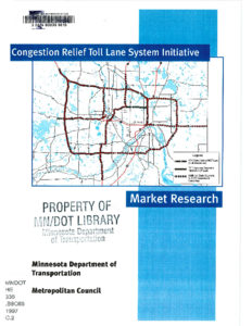
The market research effort is an outgrowth of the recommendations of the "Congestion Pricing Study" conducted by the Minnesota Department of Transportation and the Metropolitan Council, under the sponsorship of the Federal Highway Administration. This effort was completed in March 1997. One of the principal lessons learned from the public outreach effort in the Congestion Pricing study, as well as from Mn/DOT's and the private sector's experience with the TH 212 toll road initiative in 1996, was the need to develop a regional road pricing policy and plan, consistent with the Metropolitan Council's Policy Plan and with Mn/DOT's metro area Transportation System Plan. Following the Congestion Pricing study recommendations, the Metropolitan Council and Mn/DOT modified their respective planning documents to provide for the use of alternative financing options such as tolls to be considered when evaluating future transportation system improvements. Specifically, the policy allows for the potential use of tolls to help finance the cost of lane additions identified in the 20-year system plan, intended to be constructed primarily as high-occupancy vehicle lanes.

Public Understanding of State Highway Access Management Issues

Image
Date Created
1998-06
Description
The objective of this study was to understand public attitudes towards several issues related to access management. Specifically: 1. How do users perceive the role and function of specific highways experiencing significant development and increasing traffic? 2. What do citizens perceive are the problems with these roadways? 3. Given that: some people live or work next to the road, some people are trying to get to the businesses alongside the road, and some people are just passing through, what is the proper balance between access and mobility? 4. Do citizens recognize that poorly managed access to a state highway causes congestion and safety problems? 5. Who is perceived to have responsibility for managing the use of the roadway with respect to mobility, access, and safety? 6. Should existing and future businesses conform to limited access policies regarding state highways in the interest of maintaining mobility and safety? 7. How do these answers differ among the following three customer segments? Residents of the immediate vicinity, residents of the market area, travelers passing through, commuters, and/or recreational travelers? Focus groups in four study areas were held to answer these questions. During each group, respondents discussed their use of the studied highway, their perceptions of the roadway's purpose and their views on how access to businesses can best be handled without compromising mobility in the area. They were asked to describe how the roadway has changed and what impact those changes have had on their driving habits and the safety/risks of traveling in the study area.