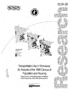
This report contains a summary of the information detailed in four separate reports covering one project. The project examines the variation in people's need for and use of transport services by posing four research questions and answering them with transportation related data from the 1990 Census of Population and Housing.
Questions posed are: 1) What is the socioeconomic profile of Minnesota's long-distance commuters?
2) How do Minnesota's counties and urban neighborhoods vary according to transport needs and use?
3) How can census data be used together with travel surveys to study the socioeconomic characteristics of
travelers? and
4) How has interaction among the state's local labor markets changed in the last twenty years?
The main findings are summarized in this report both verbally and graphically. References to the other four reports are given.
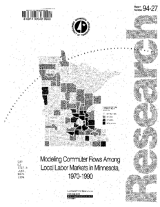
Between 1970 and 1990 the share of Minnesota commuters working outside their county of residence increased from 18 to 29 percent. This study analyzes this trend by examining commuter flows among labor markets in a 120-county study area encompassing Minnesota and counties in adjacent states.
A series of maps and statistical models relate commuter flows to changes in demographic and employment conditions over the past two decades. Commuter flows have strengthened since 1970, becoming more important in declining rural counties as well as growing suburban and exurban labor markets. Longer work journeys in declining rural areas appear to reflect individual coping strategies, as workers search farther afield for opportunities in a regional labor market undergoing a geographic transformation. For most types of jobs, employment growth is dispersing outward from metropolitan cores, while in non-metro areas jobs are consolidated into widely-spaced regional centers. These trends have created a network of diffuse labor markets in which commuter flows link widely-scattered communities of labor deficits to areas with labor surplus, in patterns too complex to be modeled solely in terms of aggregate population and housing variables.
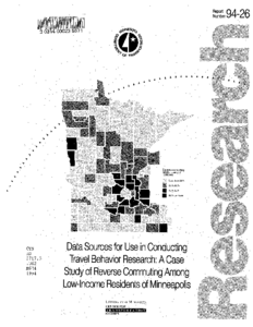
This study demonstrates applicability of two distinct data sources for travel behavior research. Questions relating to reverse-commuting are raised with respect to all working residents, and working residents in low-income households located in Minneapolis.
Census of Population and Housing, 1990 Public Use Microdata Sample (PUMS) and the Twin Cities Metropolitan Council Travel Behavior Inventory (TBI) provide details on aspects of commute and travel patterns. Examining organization and methods of analysis appropriate to determining particular travelrelated information presents a unique perspective on the advantages and shortcomings of each data set.
PUMS data provide detailed household and work-journey information. To answer reverse-commuting questions posed in this study, we consider household income, worker occupation, state and Public Use Microdata Area of employment, number of persons in each household, means of transportation used for the journey to work, and work journey duration.
TBI data contain a wealth of information on both the work journey and other trips, but lack the depth of socioeconomic data available in the PUMS file. The value of TBI data in responding to this series of questions lies in the details about trip location and purpose.
Census measures are used to classify Minnesota counties and metropolitan area census tracts according to demographic, journey-to-work, and mobility characteristics in 1990. Counties differ regarding scores calculated with respect to Population Mass-reflecting measures such as numbers of persons, of commuters, and of vehicles available for personal use; and a general Commuting tendency-reflecting proportions of commuters traveling more than 30 minutes, average commute time, and average number of vehicles per household. Three other basic characteristics of counties-average Socioeconomic Status of residents, degree of Mobility Impairment of residents; and Solo Commuting tendency-provide scores further differentiating counties. County scores are used to group Minnesota's 87 counties into six diverse clusters: 1) Hennepin (Minneapolis); 2) Ramsey (St. Paul); 3) Anoka and Dakota (Twin Cities suburbs); 4) St. Louis (Duluth); Olmsted (Rochester), Stears (St. Cloud), Washington (Twin Cities); and 6) all others.
The second analysis examines 833 census tracts in the Minnesota's five MSAs, classifying them with the procedures used for counties. Resulting classifications illustrate that relationships between travel activity and socioeconomic characteristics vary considerably for different metropolitan contexts. As a demonstration of potentially useful methods applied to census data for Minnesota, the study provided results. On other grounds, its value is more limited.
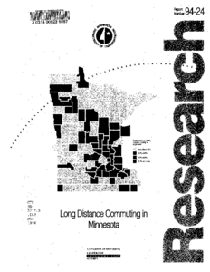
Workers making long daily commutes in the 1950s were understood as those best able to afford amenities normally available outside the "urban core"-that is, the downtown central business district (CBD) plus adjacent transportation-industrial zones and high density residential neighborhoods within "central cities" such as Minneapolis and St. Paul. This report examines characteristics of Minnesota workers residing in Minnesota's metropolitan and non-metropolitan areas who made long duration (more than 30 minutes one way) commutes in 1990, concluding that early metropolitan-based models today lack much if not all of their former applicability.
Minnesota's average commute of 19.1 minutes fell below the national average of 19.7, but more than 450,000 Minnesota workers spent more than 30 minutes commuting each way. Long duration work journeys were not restricted to the stereotypical upper income suburban family. In all geographic categories, the largest group of long duration commuters came from two person households, whose commuting may reflect compromises between two job locations.
In a five county "exurban" (i.e., beyond continuously built-up suburban areas) study area between Minneapolis and St. Cloud, average auto commuting time was the state's highest, at nearly 26 minutes. Blue collar workers reported commuting times longer than professionals. Findings have implications for policy proposals such as highway improvements, toll roads, or new energy taxes.
The continued decentralization of metropolitan areas has replaced the well-defined daily urban systems of the 1960's with complex, overlapping commuting fields. This report analyzes county-to-county commuting flows in Minnesota and counties in adjacent states to evaluate changes in the state's urban systems between 1960 and 1990.
Findings confirm that inter-county commuting has increased dramatically, from 7% in 1960 to nearly 19% in 1990. The rate of growth is diminishing, but the total number of commuters is considerable. In 1990, over 70,000 workers commuted to the seven-county Twin Cities Metropolitan Area (TCMA) from Greater Minnesota. Results of a multivariate statistical procedure, factor analysis, confirm that exurban counties between the Twin Cities and nearby regional centers have been drawn into a complex web of interconnected, overlapping urban systems.
These findings support the hypothesis that the daily work journey is creating an interdependent network of urban systems in the densely settled portions of the state. The increasing gap between the seven-county TCMA and the practical extent of the Twin Cities underscores the question whether the jurisdiction of the Metropolitan Council should expand to include counties connected by the daily flow of workers to the Twin Cities.