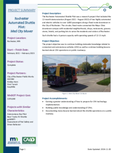
The Rochester Automated Shuttle Pilot was a research project that included the 12-month demonstration (August 2021 - August 2022) of two highly automated and electric vehicles to over 3,000 passengers along a fixed route downtown in the City of Rochester. The circular, fixed route connected the Mayo Clinic downtown campus with residential neighborhoods, shops, restaurants, grocery stores, hotels, and parking lots to serve the residents and visitors of Rochester. Each shuttle had a 6-person capacity with operating speeds of 12-15 mph.
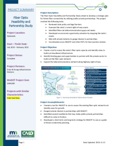
The Fiber Optic Feasibility and Partnership Study aimed to develop a strategic plan for future fiber connectivity by utilizing public-private partnerships. The project involved the following tasks:
• Reviewed state policy and legal barriers.
• Assessed the state's current right-of-way assets.
• Identified fiber and telecommunications gaps and needs.
• Developed an economic opportunity valuation by mapping the state's assets.
• Met with private industry to gauge interest in partnerships.
• Coordinated across MnDOT and other DOTs for best practice reviews.
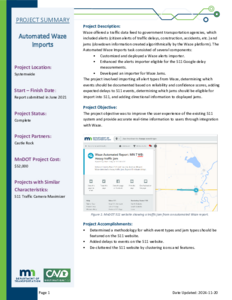
Waze offered a traffic data feed to government transportation agencies, which included alerts (citizen alerts of traffic delays, construction, accidents, etc.) and jams (slowdown information created algorithmically by the Waze platform). The Automated Waze Imports task consisted of several components:
• Customized and deployed a Waze alerts importer.
• Enhanced the alerts importer eligible for the 511 Google delay
measurements.
• Developed an importer for Waze Jams.
The project involved importing all alert types from Waze, determining which events should be documented based on reliability and confidence scores, adding expected delays to 511 events, determining which jams should be eligible for import into 511, and adding directional information to displayed jams.
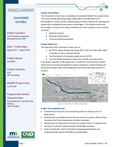
The Connected Corridor was a foundational Connected Vehicle (CV) project along TH-55 that included planning, design, deployment, and operation of CV technologies to create a better understanding of what is required for planning and preparing for emerging transportation technologies. This initiative showcased technologies to improve the safety and efficiency of the travelers on the roadway including:
• Software systems.
• Roadside infrastructure.
• On-board vehicle equipment.
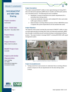
The project assessed MnDOT’s ability to share signal phasing and timing (SPaT) data and intersection geometry (MAP) data to travelers and third-party systems via a centralized process. The following tasks were completed:
• Developed a concept of operations and systems requirements for a centralized data sharing system.
• Conducted stakeholder interviews with multiple DOTs that used similar traffic signal software as MnDOT.
• Demonstrated an existing software product (Q-Free's MAXVIEW version 2.X) against the system requirements and documented the results.
The MnDOT Autonomous Bus Pilot project consisted of deploying a Level 4 shuttle provided by EasyMile on the MnROAD facility. The bus was used for several rounds of public demonstrations as well as testing at the MnROAD facility during winter conditions. The bus could hold up to 12 people and had a range of typical driving speeds from 2 to 11 miles per hour. Demonstrations were conducted in various winter conditions with several variables.
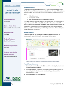
This project involved the implementation of a Traffic Camera Maximizer (TCM).The Traffic Camera Maximizer was proposed to broaden the reach of the following MnDOT assets to improve situational awareness of driving conditions across the state:
• 511 public website
• Traffic public website
• Road Weather Information System (RWIS) cameras
To achieve the goals, the project was split into two portions. The first task was to improve the usability of the public 511 website for both desktop and mobile devices. The second task involved highlighting traffic and RWIS cameras within the 511 platform where slowdowns or inclement weather could be automatically detected, and the calculated delay would be displayed on 511. This could improve quality of real-time information.
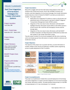
Many DOTs struggle with real-time information being relayed to their users in situations that involve lane closures. Due to the variability in location and duration, real-time integration of arrow board messages into traveler information systems became an item of interest for MnDOT to provide up-to-date data to travelers. This project involved:
• Deployment of an integrated ITS solution to report on the location and operational status of arrow boards in real time to MnDOT's Regional Transportation Management Center (RTMC) systems.
• Integration of the arrow board status information with the MnDOT Intelligent Roadway Information System (IRIS) to alert RTMC operators of lane closures who could then add messaging to nearby dynamic message signs.
• Integration of the arrow board status information with the MnDOT Condition Acquisition and Reporting System (CARS) which provided real-time updates to the traveler information system.
The pilot project involved 20 arrow boards equipped with the status monitoring unit to test displaying real-time information to travelers related to stationary and mobile lane closures.
The Variable Pedestrian Clearance Interval (VPCI) project consisted of deploying, testing, and analyzing the results of installing video at an intersection to extend the Flashing Don't Walk (FDW) interval as needed when pedestrians were still located within the crosswalk. To complete this project, the project team:
• Installed pedestrian detection equipment.
• Reviewed an initial round of testing data to find gaps in the system data.
• Determined a new path forward after identifying the data gaps.
• Tested additional pedestrian detection equipment.
• Utilized ATSPM data to verify the outcome of the pilot.
This Research Summary is part of the final deliverable for Report 2024-02, "Assessment of Pedestrian Safety and Driver Behavior Near an Automated Vehicle."