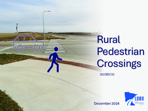
This research project summarizes various aspects of pedestrian crossings. The document is focused on pedestrian crossings in a rural environment.
This project seeks to provide a comprehensive overview of pedestrian crossings for both pedestrians and drivers by examining Minnesota statutes, summarizing key features of pedestrian crossings, synthesizing findings from existing research reports and studies, and integrating other relevant resources.
The Mayday Plus project was developed to test and establish an emergency detection and response infrastructure, and to prepare for scalable deployment of a self-sustaining automated accident location and collision severity notification system. The project consisted of a multiphased process including: system design, implementation, on-site testing, training and operational test phases. The six-month operational test provided the basis for the evaluation.
The site selected for this study was on eastbound Interstate 94 approximately 8 miles west of Alexandria in Douglas County. The work activity was crack filling in the right lane and shoulder, so Layout 21 of the Appendix B (March 1990) of the Minnesota Manual on Uniform Traffic Control Devices (MMUTCD) was used to establish the traffic controls.
This report presents the results of a one-year evaluation test of an Intelligent Transportation Systems (ITS) project known as Advanced Rural Transportation Information and Coordination (ARTIC) located in the Arrowhead Region of Northeastern Minnesota. The objective of the project focused on combining resources and streamlining dispatching operations for four transportation agencies: District 1 of the Minnesota Department of Transportation (Mn/DOT), Minnesota State Patrol (MSP) District 3100, City of Virginia Dial-a-Ride, and Arrowhead Transit Services.
Before deployment of this project, the above agencies worked independently of each other, with overlapping functions, duplicate record keeping, and stretched already scarce resources that resulted in degradation of the quality of service to the public.
The focal point of this project is a centralized communications and dispatching center, where the dispatchers communicate with maintenance and emergency vehicles, and dispatch vehicles based on an integrated database that includes functionality, availability, and real time location of vehicles in the field.
In the United States it is recognized that crashes in rural areas are a cause for concern, especially crashes at rural intersections where inherent speeds may be associated with higher fatality rates (FHWA, 2004). Recent work has shown gap acceptance problems to be the key factor contributing to these crashes (Laberge, et al., 2006) as opposed to stop sign violation (Preston & Storm, 2003). However, the majority of intersection decision-support systems implemented at intersections have not attempted to provide specific information about the nature of available gaps in the approaching traffic or information that supports a driver’s gap acceptance decision. In light of this, to reduce the crash risk at rural stop-controlled intersections, it has been recommended that intersection decision-support systems to assist drivers in responding to safe gaps be developed and deployed (Preston, Storm, Donath, & Shankwitz, 2004). The Cooperative Intersection Collision Avoidance System-Stop Sign Assist (CICAS-SSA) is an infrastructurebased driver support system that is to improve gap acceptance at rural stop-controlled intersections. The SSA system will track vehicle locations on the major road and then display messages to the driver on the minor road.
The primary goal of the current work was to evaluate several candidate CICAS-SSA concepts in order to identify a single sign that may provide the greatest utility in terms of driver performance and usability at a real-world rural intersection. A secondary goal of the current work was to determine the ideal physical characteristics (i.e., location and rotation of a sign relative to
drivers) of the candidate CICAS-SSA at a test intersection to maximize comprehension (and subsequent use) of the sign.
This study aims to determine whether passing related maneuvers trigger the high number of fatal crashes on two-lane two-way highways. The public and others perceive that fatal head-on crashes are a result of drivers who attempt to pass others on two-lane two-way highways. Public officials advocate for additional passing lanes and four lane expansions to alleviate these fatal crashes.
The Minnesota Department of Transportation (MnDOT) reviewed 251 fatal head-on crashes on Minnesota two-lane two-way highways. After careful review of police crash reports, seven (7) of 251 fatal crashes involved passing. The remaining 97% of the crashes involved vehicles drifting over the centerline, losing control of the vehicle, weather, and incorrect lane use. Drifting over the centerline alone accounted for 162 (65%) of the fatal crashes.
The Department has spent considerable effort in past years to functionally classify the entire public road system in our State. To date the only significant usage of the functional classification has been to determine which Federal-aid system the individual route will be on, i. e.: FAP, FAS, FAU, or non-Federal.
Because functional classification is a measure of the importance of mobility, roads with a high functional classification (arterials) should have higher design standards to meet this mobility need than roads with a lower functional classification (collectors
and local roads) which have lower mobility needs.
With this concept in mind, we are proposing to modify our current rural Trunk Highway design standards to consider both functional classification and ADT. Also because we currently use different magnitudes of construction, we established four different types of construction: (1) new construction or major reconstruction, (2) upgrading existing highways, (3) reconditioning or restoration of existing highways, and (4) resurfacing of existing highways. This report gives recommendations for these proposed standards.
The final meeting of the County State Aid Highway (CSAH) and Trunk Highway Rural Design Standards Task Force was held on November 3,1989. This final report is hereby submitted for review by the Steering Committee and transmittal to the Mn/DOT Operations Management Team and the Executive Committee of the Minnesota County Highway Engineers Association.
The report contains background information and recommendations developed through 14 meetings beginning in December 1988. An executive summary is included for the convenience of readers. The report will be of interest to those administering the standards, and those called upon to support them in public, as well as to those undertaking revisions in the future.
The primary objective of the Task Force was to achieve a greater measure of agreement between rural design standards used for two independent county and state highway systems supported in part by the state highway user distribution fund. This objective will have been largely accomplished if the recommendations of the Task Force are formally adopted by the authorities responsible.
Transit service in Greater Minnesota is provided through a combination of multi-county systems, single county systems, small urban systems, urban systems and large urban systems. There are 10 rural multi-county systems serving 33 counties and 30 rural single county systems. Nine of the remaining 16 counties without countywide service contain one or more of the small urban or urban systems.
The number of large urban systems in Greater Minnesota has remained constant, with Duluth the sole large urban system. Between 1993 and 1998, Duluth's ridership decreased by nine percent.
There has been no change in the number of urban systems in Greater Minnesota during the mid-1990s. East Grand Forks, Moorhead, Rochester, and St. Cloud comprise this system category. Between 1993 and 1998, urban system ridership increased by 2 percent. There has been a decrease in the number of small urban systems in Greater Minnesota during the mid-1990s as some were coordinated into countywide rural systems. Between 1993 and 1998, small urban system ridership decreased by 7 percent. A portion of the decline in ridership can be attributed to the restructuring of two small urban systems to countywide systems over the same period of time.
There has been an increase in the number of rural systems in Greater Minnesota during the mid-1990s. Between 1993 and 1998, rural system ridership increased by 75 percent. Some of the ridership increase can be attributed to the gain of 10 new systems over the same period of time.
The objectives of the overall study were as follows:
• To identify and develop a profile of current transit riders, non-riders, and those for whom transit is unavailable.
• Determine unmet transit needs.
• Measure awareness and satisfaction with current transportation services.
• Develop strategies to expand the base of possible users of public transportation.
• Provide information that would be useful in developing a marketing manual for small urban and rural public transportation providers.