This study investigates the perceived safety risks and barriers that might prevent transit and shared mobility services from attracting post-COVID riders in Greater Minnesota. It includes an online survey of Greater Minnesota residents to understand their COVID-related safety concerns and their preferences and perceptions toward existing and potential safety protocols. The survey results show that, during the post-COVID era, driving alone continues to dominate, but desires to use transit and shared mobility modes remain strong. Lack of access, lack of interest, and lack of available better alternatives jointly affect transit-use behavior. Women, people with COVID concerns, urban residents, online shoppers, and transit users are associated with stronger preferences toward COVID safety measures. People with COVID concerns, online shoppers, and transit users are also associated with preferences toward general transit service improvements. We also find that elderly people, hesitant tech users, and transit-dependent users are unlikely to be positively affected by trip-planning tools and contactless payment technology. Furthermore, income and car ownership predict future transit use, and younger age is associated with more interest in carpooling. These results help to inform transit and shared mobility providers about what safety and communications strategies will be most effective in bringing users back.
A burgeoning population seeking relatively affordable housing is placing high demands on outlying, auto-dependent residential markets. Simultaneously, public policies addressing housing, transportation, and land use aim to increase homeownership, decrease drive-alone travel, and harness outlying development. A relatively new mortgage lending procedure aims to address each of these public policy aims synergistically by allowing low- and moderate-income households the opportunity to purchase homes in transit-accessible neighborhoods that would otherwise be unobtainable because of cost. The goal of this research is to evaluate this initiative, as well as position it within the broader goals of smart growth, describe its application, and comment on its prospects. This report constitutes a primer of the current state of knowledge about these unique loan programs.
Long-term, regional travel demand models are essential tools used by planning organizations for resource management, project scheduling, and impact studies. Developed primarily at the macroscopic level, these tools lack sufficient detail to capture the influence of local geometry, dynamic traffic controls, or advanced transportation demand management (ATDM) strategies. To bridge the gap, a hybrid mesoscopic-microscopic model was developed. The core of the model, surrounding two light rail corridors in Minneapolis-Saint Paul, Minnesota, was developed at high resolution for microscopic simulation to capture the interaction between traffic signals, transit systems, and the road network. The remainder of the greater Twin Cities area was implemented based on the Regional Planning Model (RPM) maintained by the Metropolitan Council. Interfacing the Aimsun-based hybrid model with the Cube-based RPM, the Twin Cities Metro Hybrid Simulation was used to iteratively improve mode choice and traffic assignment to achieve a dynamic user equilibrium state. Important lessons were learned regarding the effort required to develop and maintain such a model with implications for future large scale regional modelling.
Human beings are creatures of habit. Traveling patterns are routines that we repeat over and over until something disrupts those patterns. When disruption occurs, there is an opportunity to entice travelers into new travel patterns. Surveys found that the highway construction in Duluth disrupted travel patterns for 40% of persons surveyed. During the Duluth Megaproject highway construction project, the Minnesota Department of Transportation (MnDOT) and the Duluth Transit Authority (DTA) used the opportunity entice travelers to transit. Additional trips and park and rides were added, which made transit more attractive to more travelers. Also, dedicated bus lanes were added to reduce travel time. Free fares enticed travelers to transit. A large promotional effort was undertaken to let travelers know about these enhanced options. Surveys of transit riders found that all of these efforts helped attract riders to transit. Surveys also looked at what factors were important for keeping riders on transit after highway construction ended. Once new habits are formed, it is likely travelers continue those habits until another event forces them to examine their travel patterns. This research found less than 15% of transit riders changed their behavior within two years and all did due to life changes, primarily job change or finishing school. It appears that once travelers change to transit, riders continue to use transit as long as it is a reasonable option. Increasing fares to normal levels did not create a significant incentive to stop using transit.
Transitways represent large public investments whose positive impacts must be maximized whenever possible to justify the expenditures they entail. Prominent among those looked-for positive impacts is the encouragement of automobile-to-transit mode shifts by attracting increased transitway ridership. This study explores the impacts of travel time, travel cost, and population density on mode choice, using the 2010 Travel Behavior Inventory. We found a monetary value of in-vehicle travel time of $17.5/hour and a transfer penalty of $10, equivalent to 35 minutes in-vehicle travel time. Density, especially at destinations, has important effects, but travel time is the key to promote the shift to transit. The research also employs a Direct Ridership Model (DRM) to predict boardings at the station level as a function of transit-supportive policies. We find that station-area focused policies promoting affordable housing and sidewalks on all streets in station areas or entire cities have a significant and positive impact on ridership if there are sufficient potential destinations in the immediate station area, measured as the number of Google places within 100 meters. Based on our results, we stress the importance of station area affordable housing as a transit system efficiency measure, as well as for the social equity reasons it is usually encouraged. We recommend strengthening pro-affordable housing policies and pro-sidewalk policies in Twin Cities station areas, supporting and encouraging for the neighborhood-scale commercial development that is required for their efficacy, and the continued implementation of pro-affordable housing policies and pro-sidewalk policies as the regional transitway system expands.
This research project investigates the status of personal rapid transit (PRT) applications in airport environments, to understand the characteristics and attributes of these systems, to explore the viability of a PRT system in the Minneapolis-St. Paul International Airport, and to prepare a synthesis report and presentation that document the project's findings.
This report discusses the potential benefits and perceived impediments to implementing an automated rapid transit (ART) system in the Twin Cities and Minnesota. The report also briefly reviews the status of ART applications, also referred to as personal rapid transit (PRT), in the United States and abroad. Finally, the report evaluates the potential ability of ART to promote the policy goal of creating efficient development, livable communities, and work opportunities through a variety of relevant strategies. The report concludes that an ART feasibility study is needed to provide more definitive answers to issues and questions raised about ART, and it provides the rationale for funding such a study, as well as an outline of the elements of the feasibility analysis.
Report #9 in the series: Access to Destinations Study. Conventional transportation planning is often focused on improving movement (or mobility) - most often by the automobile. To the extent that accessibility, a well-known concept in the transportation planning field since the 1950s, has been measured or used in transportation planning, such measures have also been auto-based. Broadening the scope of accessibility to include a wide array of destinations and non-auto modes such as walking, cycling, and transit has been previously proposed as a much needed aim among planning initiatives. A central issue is that to date, however, there have been few examples of measures draw from. When it comes to bicycling, walking, and transit measures of accessibility are an endeavor long on rhetoric but short on execution. This report discusses such hurdles, presents alternatives for overcoming them, and demonstrates how accessibility for walking, cycling, and transit - and for different types of destinations - can be reliably measured. We focus on explaining specific features of non-motorized transportation that complicate the development of accessibility measures, and offer solutions that conform to conventional transportation planning practice. In this research project, non-motorized measures of accessibility were developed for the entire seven counties of the Twin Cities (Minnesota, USA) metropolitan area. For purposes of this exposition in this report, we discuss the details of creating such measures using a sample application from Minneapolis, Minnesota, USA to demonstrate proof of concept for the endeavor.
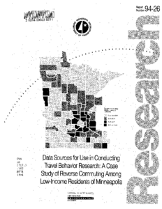
This study demonstrates applicability of two distinct data sources for travel behavior research. Questions relating to reverse-commuting are raised with respect to all working residents, and working residents in low-income households located in Minneapolis.
Census of Population and Housing, 1990 Public Use Microdata Sample (PUMS) and the Twin Cities Metropolitan Council Travel Behavior Inventory (TBI) provide details on aspects of commute and travel patterns. Examining organization and methods of analysis appropriate to determining particular travelrelated information presents a unique perspective on the advantages and shortcomings of each data set.
PUMS data provide detailed household and work-journey information. To answer reverse-commuting questions posed in this study, we consider household income, worker occupation, state and Public Use Microdata Area of employment, number of persons in each household, means of transportation used for the journey to work, and work journey duration.
TBI data contain a wealth of information on both the work journey and other trips, but lack the depth of socioeconomic data available in the PUMS file. The value of TBI data in responding to this series of questions lies in the details about trip location and purpose.
This Technical Summary pertains to Report 2023-16, “Understanding Post-COVID Safety Concerns Toward the Use of Transit and Shared Mobility in Greater Minnesota,” published April 2023.