Minnesota Governor's Council on Connected and Automated Vehicles: 2024 Annual Report

Image
Date Created
2025-02
Description
In 2024, Minnesota continued to be a national leader with its connected and automated vehicles (CAV) academic research, industry work, and partnerships with state and local governments. Minnesota’s on-going AV pilot project in Grand Rapids, Minnesota, goMARTI, continues to gain national and international recognition for both its emphasis on AV technology advancements and increasing accessibility for folks with limited transportation options. After a pause in 2023, the Governor’s Council on CAV restarted in 2024 with new members, and was a year rich in accomplishments, making progress on established recommendations. This iteration of the Council strives to be more action-focused and establish clear CAV-based recommendations for Minnesota by looking at what our state needs, where there is opportunity, and where there is risk. The members represent a variety of backgrounds, bringing valuable perspectives which enhance the discussion and provide recommendations that support all Minnesotans.

Project Summary: Automated Truck Mounted Attenuator (ATMA)

Image
Date Created
2025
Report Number
2025-26
Description
Connected and automated vehicle (CAV) technology has the potential to significantly increase work zone safety. Each day, MnDOT maintenance employees and contractors are at risk of being involved in crashes when performing road work. To mitigate this risk, MnDOT uses truck mounted attenuators – or crash cushions – to help protect roadside workers)

Project Summary: Community Driven CAV

Image
Date Created
2025-02
Report Number
2025-20
Description
We envisioned a project—a future—where the community is at the forefront of planning and implementation of new technology. Technologies are often developed by select companies and universities, and then tested in communities. Instead of leading with a solution, Community Driven CAV started by understanding community needs and assets, and then creatively explored ways that connected and automated technologies could address them. We wanted the community to drive what technology and use cases we plan for, develop and test. We sought to upturn the usual way of doing business to create a stronger and more equitable transportation future. First the project team conducted three community listening sessions to understand the community’s transportation challenges. Next a workshop with community members and technical experts was held to discuss how CAV technology could potentially help address the identified transportation challenges. This work resulted in potential demonstration concepts for the Creative Enterprise Zone and a Community-Driven Planning Framework, which can be used by others looking to do community led planning.

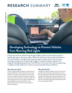
Development and demonstration of a novel Red Light Running Warning System using connected v2i technology

Image
Date Created
2024-12
Report Number
2024-33
Description
Running red traffic signals is a major cause of traffic collisions and resulting injuries and fatalities. Despite extensive prior work on systems to reduce red light violations, they continue to be a major problem in practice, partly because existing systems suffer from the flaw of providing the same guidance to all drivers. As a result, some violations are avoided, but other drivers ignore or respond inappropriately to red light running systems, resulting in safety issues overall. We present a novel method of providing accurate warnings to individual drivers to avoid the broad guidance approach of most existing systems. Recognizing if a driver will run red lights is highly dependent on signal phase and timing, traffic conditions along the road, and individual driver behavior, the proposed warning system contains three parts: a traffic prediction algorithm, an individual warning signal optimizer, and a driver warning display. The traffic prediction algorithm predicts future traffic states along the road towards the signalized intersections using the latest traffic conditions obtained through vehicle-to-vehicle and vehicle-to-infrastructure communications. Then, an optimization problem is formulated to compute the optimal warning signal based on predicted traffic states and driver reaction model. Finally, the optimal warning signal is shown on the display screen to advise driver on how much braking is needed to avoid running the red light. The results of both simulated driving scenarios and real-world road tests show that the proposed system provides more effective and accurate warning signals to drivers, helping them avoid running red lights.

Project Summary: Cost/Benefit Analysis of Fuel-Efficient Speed Control using SPaT Data

Image
Date Created
2024-11
Description
MnDOT’s Connected Corridor project in 2020 contributed to progress in the development and deployment of technology for vehicle-to-infrastructure communications. Using signal phasing and timing (SPaT) data from signalized intersections to control driving speed, this project completed a cost benefit analysis for use of SPaT data in connected vehicles (CVs) and its effect on fuel efficiency. The analysis was performed by: • Outfitting four vehicles with communications and tools to record SPaT data, geometric lane data, vehicle trajectories, and speed / acceleration profiles. • Developing a traffic flow prediction model and speed control method from the previously collected data which could predict upcoming traffic and calculate the vehicle’s optimal speed to minimize fuel consumption. • Re-driving the test corridors to refine the model and speed control method. • Performing laboratory testing to predict and evaluate fuel savings from CVs driving the corridor. The analysis was completed for diverse traffic scenarios at different CV market penetrations ranging from 10% to 90%

Project Summary: Connected Vehicle Traveler Alert System

Image
Date Created
2024-11
Description
The Connected Vehicle Traveler Alert System project was implemented to increase traveler awareness and subsequently increase safety of the traveling public by notifying them of upcoming maintenance vehicles or snowplows that may not have been in the line of sight. This was tested by sending maintenance vehicle location data gathered by an automatic vehicle location (AVL) system to a MnDOT server where the data was sent to: • The Transportation Management Center (TMC) which allowed for the display of a dynamic message sign (DMS) message to the traveling public that a maintenance vehicle was ahead. • An application running on a smart phone/mobile device of drivers who were approaching the maintenance vehicle at a specified distance.

Project Summary: Drive MN

Image
Date Created
2025-01
Description
Automated vehicles (AVs) rely heavily on roadway infrastructure to function. This project used technology-equipped research vehicles to drive over 1,000 miles of Minnesota roadways to gain a better understanding of potential infrastructure issues that would inhibit the operations of AVs. The outcomes of this project were intended to be used by transportation professionals to make improvements to allow for the operation of automated driving and Advanced Driver Assistance Systems (ADAS). Data was gathered with vehicle technology and sensors to collect radar, LiDAR, and video data which was post-processed to identify problematic areas and place issues into the following buckets: • Freeway ramps and turn lanes. • Poor lane line condition and visibility. • Construction and maintenance activities. • Poor contrast. • Tight curvature. • Environmental issues. • Dynamic lanes. Along the drive, the team hosted live events in every MnDOT district to provide information about Connected and Automated Vehicles (CAVs), the state of the industry and vehicle technology, as well as observations made along the drive.

Project Summary: Smart Snelling

Image
Date Created
2024-11
Description
The Smart Snelling project was comprised of two main components: • Testing a third-party application to provide users signal phasing and timing (SPaT) information. • Testing snowplow signal priority. MnDOT and Ramsey County installed connected vehicle technology equipment at 16 intersections owned by MnDOT and Ramsey County. The project tested the equipment’s ability to provide snowplow signal priority by communicating with the onboard unit on the plow truck. The project also tested the “TravelSafely” mobile phone application’s capabilities to provide real-time information accurately and effectively about signal phasing and timing to inform travelers of phase changes, red-light running, and presence of pedestrians/cyclists.

Project Summary: Automated Waze Imports

Image
Date Created
2024-11
Description
Waze offered a traffic data feed to government transportation agencies, which included alerts (citizen alerts of traffic delays, construction, accidents, etc.) and jams (slowdown information created algorithmically by the Waze platform). The Automated Waze Imports task consisted of several components: • Customized and deployed a Waze alerts importer. • Enhanced the alerts importer eligible for the 511 Google delay measurements. • Developed an importer for Waze Jams. The project involved importing all alert types from Waze, determining which events should be documented based on reliability and confidence scores, adding expected delays to 511 events, determining which jams should be eligible for import into 511, and adding directional information to displayed jams.