Pathways to Decarbonizing Transportation in Minnesota

Image
Date Created
2019-08
Description
The Pathways to Decarbonizing Transportation project began a conversation about moving Minnesota towards a low-carbon transportation future. Minnesota’s climate is changing, which already affects our health, environment, and economy, with warmer winters and more precipitation being recorded now and forecast to increase in the future. In 2007, the state passed the bi-partisan Next Generation Energy Act (NGEA) that established goals for the state to reduce greenhouse gas (GHG) emissions by 15% below 2005 levels by 2015, 30% by 2025, and 80% by 2050. However, the state did not meet our 2015 goal and we are not on track to meet our future goals. Transportation is now the largest emitter of GHGs in the state. To achieve our GHG reduction goals, state-level action is needed and there are many opportunities for immediate action in the transportation sector. Pathways was a collaborative effort between state agencies and Minnesota Department of Transportation (MnDOT), Environmental Quality Board, Minnesota Pollution Control Agency, Minnesota Department of Agriculture, and the Minnesota Department Commerce. The purpose of Pathways was to explore opportunities for GHG emission reductions from surface transportation: passenger cars and trucks, medium-duty and heavy-duty trucks, buses, motorcycles, and mobile air conditioning. The project had three connected parts: 1. Coordinate with state and national experts to develop a model based on their expertise 2. Model future scenarios of GHG emissions 3. Engage with Minnesotans around the state to hear their thoughts on opportunities and challenges in their communities for reducing GHG emissions from transportation.

MnDOT Flash Flood Vulnerability and Adaptation Assessment Pilot Project

Image
Date Created
2014-11
Description
Minnesota’s climate is changing. Temperatures are on the rise and extreme precipitation events and associated flooding are becoming more frequent and severe. As the Earth continues to warm, these events are projected to become even more common since a warmer atmosphere is capable of holding more water vapor. Flooding presents a challenge to fulfilling the Minnesota Department of Transportation’s (MnDOT) mission to, “Plan, build, operate, and maintain a safe, accessible, efficient, and reliable multimodal transportation system..." When roads become inundated, the safety of motorists can be threatened, efficiency is reduced by the need to take detours, and system reliability is compromised. Recognizing this, MnDOT planners and engineers have long considered minimizing the risk of flash flooding in the siting and design of the state’s roadway network. However, as has been the standard practice worldwide, they have traditionally assumed that future climate conditions will be similar to those recorded in the past. Climate change challenges this assumption and calls for new approaches to understanding vulnerabilities across the highway system and at specific transportation facilities so that appropriate actions, adaptations, can be taken to minimize expanding risks. This project, one of 19 Federal Highway Administration (FHWA) climate vulnerability pilot studies nationwide looking at the effects of climate hazards on the transportation system, represents a starting point for developing these new approaches. The focus of this pilot study is on flash flooding risks to the highway system. While flooding is not the only threat to the state’s highway system posed by climate change,3 it is likely to be one of the most significant and has already caused extensive disruptions to the transportation system in many areas.

Infrastructure Carbon Estimator version 2.1: Final Report and User’s Guide

Image
Date Created
2020-08
Description
Energy and greenhouse gas (GHG) emissions associated with the construction and maintenance of transportation systems are an important part of the total environmental impact of transportation. Assessments of energy and GHG emissions from transportation typically focus on the energy and fuel used by vehicles in travel. However, some state Departments of Transportation (DOTs) and metropolitan planning organizations (MPOs) consider construction and maintenance emissions associated with their long-range transportation plans and of individual projects for inclusion in Environmental Impact Statements (EIS). With over four million miles of highways and over 16,000 miles of bridges in the U.S., overlooking infrastructure can exclude a significant portion of total impacts. ICE was created to solve the problem of “planning level” estimation of embodied carbon emissions in transportation infrastructure. Without the need for engineering studies, ICE helps answer this question: How much carbon and energy is associated with the building, modification, maintenance, and/or use of this transportation project (or group of projects)? ICE is designed to allow users to create pre-engineering, “ballpark” estimates of lifecycle energy and GHG emissions using limited data inputs. It generally avoids requiring detailed data that would be derived from engineering documents and construction plans. This approach allows the tool to be used in conjunction with transportation planning and NEPA processes, before details about specific facility dimensions, materials, and construction practices are known.

Development of Mix Designs and Matrix of Materials for MnROAD Low Carbon Concrete Test Site

Image
Date Created
2024-03
Report Number
NRRA202401
Description
To address climate change mitigation goals, alternative concrete paving mixtures are being investigated that are claimed to have a lower global warming potential (GWP) at time of construction with equal or better long-term performance compared to conventional concrete paving mixtures currently in use by the Minnesota Department of Transportation (MnDOT). The objectives of this study are to develop a final matrix of test sections and a construction quality assurance (QA) plan for the construction of a Minnesota Road Research Facility (MnROAD) experimental section, consisting of 16 test cells, to assess the environmental impact and constructability of various concrete paving mixtures designed to reduce environmental impact, with the opportunity to assess in-service performance over a three-year period following test cell construction. This report documents the concrete mixtures being evaluated, the list of tests to be performed on the plant-produced concrete, construction observations, and a preliminary assessment of environmental impact. Follow-up studies are ongoing, which will document the lab testing results and provide yearly performance updates on the test cells. These reports will be made available by MnDOT.

Effect of Increased Precipitation (Heavy Rain Events) on Minnesota Pavement Foundations

Image
Date Created
2024-04
Report Number
2024-08
Description
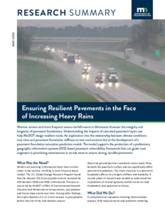
The Midwest region of the United States, including Minnesota, has been experiencing an increase in the number of heavy precipitation events. Historical precipitation data confirmed an increasing trend of heavy precipitation in Minnesota in the 21st century. This study focused on assessing the impact of heavy-precipitation events on moisture levels and stiffness of pavement foundation layers at the MnROAD facility. A two-step approach was adopted for predicting changes in saturation and for estimating corresponding resilient modulus values using the resilient modulus prediction equation employed in AASHTOWare Pavement Mechanistic-Empirical (ME) design. PLAXIS 3D, a finite element analysis tool, was used to simulate the movement of moisture within the pavement layer under varying heavy rainfall scenarios. Multiple linear regression models were developed from rainfall simulation data of the PLAXIS 3D model to predict base layer saturation based on rainfall characteristics and hydraulic conductivity of the material. ArcGIS Pro was then used to develop a framework to generate a preliminary vulnerability map showing changes in the resilient modulus of the pavement base layer from rain events. Four regression models were developed and used in ArcGIS Pro to predict changes in resilient modulus for distinct aggregate types under heavy rainfall events, revealing significant reductions in the base layer's resilient modulus. Recycled aggregate (a mix of recycled concrete aggregate and recycled asphalt pavement) emerged as more susceptible, with initial reductions in modulus values higher under heavy rainfall.

Intensity of Extreme Rainfall Over Minnesota

Image
Date Created
1998-11
Report Number
1998-09U
Description
This study looks at precipitation design values, among the most important and widely used pieces of climatological information. Researchers explored the question of whether a high-density network can result in more realistic time series of annual 24-hour extreme precipitation amounts. They also looked at the possible impact of the variability and fluctuations of climate, since standard sources assume a static climate. Study areas included Minneapolis and St. Paul, and an area west of Duluth, Minnesota, near Hibbing. The following highlights study conclusions: * The spatial variability of the design values estimated for 20 km by 20 km is far too great to make that approach practical. * Based on the experience with the Hibbing study area, it is likely that the density of observations over large parts of the state would be too small to allow using 10 km by 10 km or 20 km by 20 km areas. * If the purpose of the design values is to provide guidance on extreme precipitation likely to be experienced a point, the current standard sources underestimate the values about one inch for a 24-hour duration and 100-year return period. * If the purpose of the design values is to provide guidance on extreme precipitation likely to be experienced at some point over an area, the current standard sources greatly underestimate the values. * There are no long-term trends in the magnitude of extreme precipitation events. This report is unpublished. 15 copies were produced and distributed.

Climate Change Adaptation of Urban Stormwater Infrastructure

Image
Date Created
2023-06
Report Number
2023-21
Description
The final analysis of historical (TP-40), current (Atlas 14), and future predicted storm events for three watersheds in Minnesota (Duluth, Minneapolis, Rochester) has shown that current design philosophy is not sufficient to prevent flooding from 10-year and larger design storm events and that flood depth and duration will increase given current climate projections. Several stormwater infrastructure adaptation strategies were assessed for reducing flood depth and duration: Baseline (existing conditions), adding rain gardens (aka, Infiltration Basins), adding new wet ponds, retrofitting existing stormwater ponds to be “Smart Ponds, adding new Smart Ponds while also converting existing ponds into Smart Ponds, or upsizing of stormwater pipes to convey more water. In watersheds that are mixed urban, suburban, and rural like Rochester’s Kings Run or Duluth’s Miller Creek sub-watersheds, the most cost-effective climate change adaptation strategy was to build new stormwater wet ponds (Extra Ponds strategy) to treat the impervious surfaces not currently treated by existing wet ponds and other stormwater BMPs. In the fully developed urban 1NE watershed in Minneapolis, the most cost-effective (excluding land costs) climate change adaptation strategy was building wet ponds (Extra Ponds). Securing property for building new stormwater infrastructure in fully developed urban watersheds like 1NE may be a substantial cost compared to other watersheds. Smart Ponds do not require additional land for implementation and thus represent a relatively low-cost alternative that will be more beneficial in watersheds with numerous existing wet ponds.