Development and demonstration of a novel Red Light Running Warning System using connected v2i technology

Image
Date Created
2024-12
Report Number
2024-33
Description
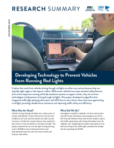
Running red traffic signals is a major cause of traffic collisions and resulting injuries and fatalities. Despite extensive prior work on systems to reduce red light violations, they continue to be a major problem in practice, partly because existing systems suffer from the flaw of providing the same guidance to all drivers. As a result, some violations are avoided, but other drivers ignore or respond inappropriately to red light running systems, resulting in safety issues overall. We present a novel method of providing accurate warnings to individual drivers to avoid the broad guidance approach of most existing systems. Recognizing if a driver will run red lights is highly dependent on signal phase and timing, traffic conditions along the road, and individual driver behavior, the proposed warning system contains three parts: a traffic prediction algorithm, an individual warning signal optimizer, and a driver warning display. The traffic prediction algorithm predicts future traffic states along the road towards the signalized intersections using the latest traffic conditions obtained through vehicle-to-vehicle and vehicle-to-infrastructure communications. Then, an optimization problem is formulated to compute the optimal warning signal based on predicted traffic states and driver reaction model. Finally, the optimal warning signal is shown on the display screen to advise driver on how much braking is needed to avoid running the red light. The results of both simulated driving scenarios and real-world road tests show that the proposed system provides more effective and accurate warning signals to drivers, helping them avoid running red lights.

Project Summary: Centralized SPaT and MAP Data Sharing

Image
Date Created
2024-11
Description
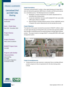
The project assessed MnDOT’s ability to share signal phasing and timing (SPaT) data and intersection geometry (MAP) data to travelers and third-party systems via a centralized process. The following tasks were completed: • Developed a concept of operations and systems requirements for a centralized data sharing system. • Conducted stakeholder interviews with multiple DOTs that used similar traffic signal software as MnDOT. • Demonstrated an existing software product (Q-Free's MAXVIEW version 2.X) against the system requirements and documented the results.

Best Practices for the Design and Operation of Reduced Conflict Intersections

Image
Date Created
2016-10
Description
Kimley-Horn, under contract with the Minnesota Department of Transportation (MnDOT), has conducted a review of guidance documentation on the design and operation of Reduced Conflict Intersections (RCIs), with a particular focus on signal-controlled RCIs. In addition to synthesizing information from a variety of sources, MnDOT also interviewed representatives from the Texas Department of Transportation (TxDOT) and the North Carolina Department of Transportation (NCDOT)—the two states with the most implemented signalized RCIs in the United States at this time. This document summarizes the findings of this literature review, and is intended to be used as a working best practices guidance document for the design and operation of signalized RCIs in Minnesota.

CICAS HF3: Sign Comprehension, Rotation, Location, and Random Gap Simulation Studies

Image
Date Created
2008-09
Description
In the United States it is recognized that crashes in rural areas are a cause for concern, especially crashes at rural intersections where inherent speeds may be associated with higher fatality rates (FHWA, 2004). Recent work has shown gap acceptance problems to be the key factor contributing to these crashes (Laberge, et al., 2006) as opposed to stop sign violation (Preston & Storm, 2003). However, the majority of intersection decision-support systems implemented at intersections have not attempted to provide specific information about the nature of available gaps in the approaching traffic or information that supports a driver’s gap acceptance decision. In light of this, to reduce the crash risk at rural stop-controlled intersections, it has been recommended that intersection decision-support systems to assist drivers in responding to safe gaps be developed and deployed (Preston, Storm, Donath, & Shankwitz, 2004). The Cooperative Intersection Collision Avoidance System-Stop Sign Assist (CICAS-SSA) is an infrastructurebased driver support system that is to improve gap acceptance at rural stop-controlled intersections. The SSA system will track vehicle locations on the major road and then display messages to the driver on the minor road. The primary goal of the current work was to evaluate several candidate CICAS-SSA concepts in order to identify a single sign that may provide the greatest utility in terms of driver performance and usability at a real-world rural intersection. A secondary goal of the current work was to determine the ideal physical characteristics (i.e., location and rotation of a sign relative to drivers) of the candidate CICAS-SSA at a test intersection to maximize comprehension (and subsequent use) of the sign.

A Study of the Traffic Safety at Reduced Conflict Intersections In Minnesota

Image
Date Created
2017-05
Description
In 2010, the Minnesota Department of Transportation installed the first Reduced Conflict Intersection (RCI) in the City of Willmar. Since 2010, seven more were constructed, with more planned. The RCI concept is gaining popularity in several states, including Maryland, Mississippi, Missouri, North Carolina, and Wisconsin. This report includes findings from a safety performance evaluation of Minnesota Reduced Conflict Intersections. This evaluation found: - A 100% reduction of fatal and serious injury right-angle crashes - A 77% reduction of all severity right-angle crashes - A 50% reduction of injury crashes Additionally, compared to their untreated counterparts, Reduced Conflict Intersections showed significantly fewer severe right-angle crashes and severe crashes, and the crashes observed at an RCI intersection were of lower crash severity than their untreated counterparts.

Four legged intersections with bypass lanes study: final report

Image
Date Created
2001-05
Description
1) After an exhaustive study of collisions occurring at virtually all the 4 Legged Intersections with Bypass Lanes on state highways in the State of Minnesota - totaling 100 Intersections over a 5 year period (1995-1999), this author has found no reason from a collision standpoint that the use of Bypass Lanes should be curtailed. 2) Crash rates per million vehicles are very low for all these 100 Intersections. One would expect that if there was a problem with Bypass Lanes at 4- Legged Intersections, that the Crash Rate would be high at those intersections. This is not the case in this study. 3) Crashes related to the presence of Bypass Lanes at the 100 Intersections in our study were extremely low. Determination on whether a collision was related to the presence of a Bypass Lane was determined by asking the question, "if the Bypass Lanes were not in place which collisions would still occur?" All of these collisions were discarded, and those left were deemed to be the result of the Bypass Lane. 4) There were 461 collisions per 100 Intersections per the 5 year study period. This averaged 92.2 Collisions per year/100 Intersections. There were 0.92 collisions per Intersection per year. 5) Crashes related to the presence of Bypass Lanes in this 100 Intersection Study were 36 crashes per 5 year period, which averaged 7.2 crashes per year per 100 Intersections. This means that there were 0.07 collisions per intersection per year related to a Bypass Lane. 6) It is the opinion of the author that many collisions related to Bypass Lanes could have been averted had proper standardized signing and pavement markings been in place.

Pedestrian Risk on Anishinaabe Reservations in Minnesota: Overview and Phase 2 Results

Image
Date Created
2024-06
Report Number
2024-18
Description
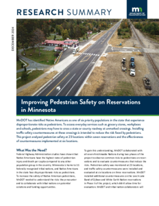
Studies by the Federal Highway Administration show that American Indians have higher rates of pedestrian injury and death per capita than any other population group in the United States. The Minnesota Department of Transportation (MnDOT) has identified Native Americans as one of six priority populations in Minnesota that face disproportionate risks as pedestrians. This report summarizes efforts taken between 2016 and 2024 to document and reduce risks to pedestrians on the seven recognized Anishinaabe reservations in Minnesota. Across reservations, researchers monitored pedestrian crossings using video recorders at 23 different sites identified by Tribal transportation managers, including 10 Phase 1 sites (2016-2020) and 13 Phase 2 sites (2019-2024). Monitoring results, including pedestrian counts, interactions with drivers, and yield rates, were used to inform planning and implementation of countermeasures to reduce crash risk at six Phase 1 sites and two Phase 2 sites. These countermeasures included marked crosswalks with pedestrian landing pads, better lighting and signage; ADA-accessible pedestrian access ramps; and a pedestrian hybrid beacon. Additional countermeasures have been scheduled or planned for 2024 or later at six more locations. Post-implementation monitoring at six Phase 1 sites confirmed that countermeasures change pedestrian and driver behaviors, but not all pedestrians or drivers use countermeasures as designed. Implementation of countermeasures may change risk factors and reduce risks, but risks cannot be eliminated and will remain after countermeasures are implemented. Consultation, coordination, and cooperation among Tribal, state, and local transportation planners and engineers are essential to reducing crash risk and increasing pedestrian safety.