series within Research Reports collection

School start times impact on students walking or biking to school: Safe routes to school

Image
Date Created
2025-04
Report Number
2025-21
Description
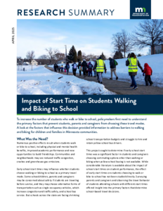
Some school districts schedule elementary schools with early start times for various reasons. Such start times sometimes necessitate travel before sunrise during winter months. Intuitively, this could potentially conflict with a desire for increased use of active transportation, e.g. from the Safe Routes To School program, to reduce motor vehicle travel and associated traffic congestion from driving students to school. Since prior literature has identified that parents are concerned about child safety around traffic, it is possible that travel before sunrise (where visibility is reduced) would also be a concern to parents and further discourage active transportation. To answer this question, we conducted a stated preference survey of parents about their child's travel choices, asking parents to rank the importance of various factors including travel before sunrise. Due to concerns about whether stated parental preferences would align with actual behavior, we also conducted a revealed preference survey using StreetLight data on travel to elementary schools. Survey distribution and data collection occurred in February in Minnesota, during a period of late sunrise. Overall, the results from all data analyses are aligned. Early school start times were associated with slightly higher use of active transportation in both stated and revealed travel patterns. Parents ranked travel before sunrise only as a moderate concern behind distance, infrastructure, crossing busy roads, and child's age. We did not find data to conclude that travel before sunrise significantly limits use of active transportation.

Comparison of Compost and Proprietary Soil Amendments for Vegetation Establishment

Image
Date Created
2025-03
Report Number
2025-22
Description
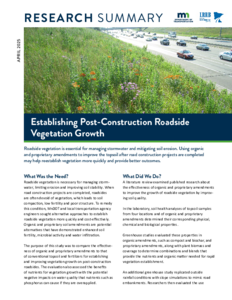
Post-construction roadside soils often suffer from compaction, low fertility, and poor structure, challenging vegetation establishment and stormwater management. This study evaluates the effectiveness of organic amendments (OAs) and proprietary amendments as alternatives to traditional methods. The study involves greenhouse experiments (pot and mesocosm) and field experiments to evaluate vegetation growth and water quality across different amendment and soil applications. Results show that compost amendments significantly improve vegetation growth, with yard-waste compost outperforming others. Biochar shows early growth potential but requires nutrient supplementation for sustained performance. Proprietary amendments support rapid vegetation establishment, enhanced root density, and reduced nutrient leaching, with Sustane 4-6-4 exhibiting consistent growth across application rates. The field study validates greenhouse findings and shows increased biomass and root density with compost amendments, while proprietary amendments result in high nutrient retention and runoff quality. This study highlights the potential use of OAs and PAs to reduce erosion and support long-term vegetation growth. The findings provide practical guidelines, benefits and implementation steps for managing roadside soils after construction activities.

Value of Dedicated Right-of-Way: Transit Service Reliability and User Impacts

Image
Date Created
2025-02
Report Number
2025-01
Description
Transit services connect people to jobs and opportunities, fostering vibrant communities and multimodal travel along service corridors. A transit right-of-way (ROW) can help buses bypass congestion and stay on schedule. Many studies have proved that transit ROWs effectively improve service reliability and reduce user costs. However, these studies often focus on one or two service corridors, limiting comprehensive impact assessment. This project addresses this gap by investigating service reliability for all route segments across a transit system. We derived reliability metrics at the route segment level using high-resolution automatic vehicle location (AVL) and automatic passenger count (APC) data collected in the Twin Cities metropolitan area. We then collected and integrated data from various sources via spatial-temporal computing to capture service characteristics, operating environments, traffic conditions, and land-use features along route segments. We applied the Gradient Boosting Model (GBM) to examine nonlinear relationships between these factors and bus travel time reliability. Lastly, we used the trained model to estimate potential improvements in reliability with dedicated ROWs. Through these steps, we worked with members of the Technical Advisory Panel (TAP) to illustrate our methodology and demonstrate its utility for transit agencies. Specifically, the results proved that the ratio of bus lanes and busways was associated with more reliable travel time along route segments. We also found that route segments along a few service corridors with unreliable services can greatly benefit from implementing a dedicated ROW.

Assessing the Deterioration of Pedestrian Assets

Image
Date Created
2025-02
Report Number
2025-19
Description
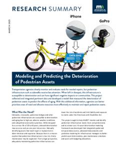
Pedestrian assets, particularly sidewalks, are highly susceptible to aging, adverse weather conditions, and suboptimal construction practices, often leading to rapid deterioration. This deterioration is often ignored due to the widespread misconception that pedestrian assets are low risk, resulting in many deteriorated sidewalks being left untreated or inadequately maintained. A comprehensive deterioration modeling framework that integrates advanced spatial and temporal data sources, advanced data analytics, and predictive modeling would enable infrastructure managers to predict the aging process of pedestrian assets and ultimately prioritize investments, plan maintenance schedules, and allocate budgets efficiently. This project developed assessment frameworks and deterioration models for pedestrian assets that support reliable and informed decision-making regarding funding needs and asset design and maintenance. Various data sources and modeling and analysis procedures were explored, and a pedestrian asset assessment methodology was developed and evaluated. The research demonstrated a scalable and cost-effective approach to assessing sidewalk conditions, providing actionable insights for proactive maintenance. The quantifiable benefits, including construction savings, improved life-cycle costs, reduced risk, and safety enhancements, position this methodology as a valuable tool for sustainable infrastructure management.

Pavement Marking Patterns and Widths – Human Factor Study

Image
Date Created
2025-03
Report Number
2024-34
Description
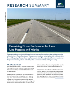
Various broken lane line configurations, marking length and gap between markings, exist across the United States. The normal width of pavement markings and the use of contrast markings with broken lane lines also varies across the country. This project explored how various pavement marking configurations impact observations from drivers during an open road human factors evaluation. The participants drove an instrumented vehicle through test areas with various pavement marking configurations. Participants provided feedback on marking visibility and their preference toward the pavement marking pattern. Participant observations took place during the day and at night. Researchers also conducted a preliminary investigation into the same marking test areas using an advanced driver assistance system (ADAS). The study found that drivers preferred wider broken lane line markings, and broken lane line markings with more marking and less gap than current MnDOT practice. No specific preferences were found for contrast markings. The researchers recommend that MnDOT adopt the 12.5-foot to 37.5-foot broken lane line pavement marking pattern as it is preferred by road users and maintains the current MnDOT 50-foot cycle length. In addition, to skip line and gap dimensions, the research team also recommends MnDOT adopt 6-inch-wide pavement markings as the research results show that not only are 6-inch-wide pavement markings preferred over 4-inch-wide pavement markings by road users, they also offer a safety benefit.