I-35W/Crosstown Concept Study: Final Report

Image
Date Created
2002-01
Description
The reconstruction of the interchange of I-35W and the Crosstown Highway (TH 62) has been anticipated for many years. It is one of the most heavily traveled and most congested points in the Metropolitan area roadway system. The Minnesota Department of Transportation (Mn/DOT) developed a plan for reconstruction that would have begun in 2001. The plan focused on the addition of a high-occupancy vehicle (HOV) lane in each direction, minimization of right-of-way takings, and safety improvements in the common section. With those goals driving the design process, the resulting plan included many long-term closures of many movements through and within the interchange. As a result of public opposition to the plan, the Legislature directed Mn/DOT not to proceed with construction until May 2002, and to retain consultant assistance in the preparation of an analysis of expected travel demand through the interchange and in the exploration of alternative designs.

Trunk Highway 7 Corridor Study: Revised Executive Summary and Resolution of Comments

Image
Creator
Date Created
1996-03
Description
This document serves as an addendum to the Trunk Highway 7 Corridor Study. The corridor study was prepared by BRW, Inc., and submitted to Mn/DOT and the TH 7 Steering Committee in February 1996. BRW, Inc./ and Mn/DOT received comments from the TH 7 Steering Committee in early March 1996 (comments / meeting minutes are included in the appendix). This addendum was prepared to respond to these comments. The addendum includes a revised Executive Summary of the Corridor Study and resolution of Steering Committee comments.

Experimental evaluation of a freeway noise barrier I-35W at Minnehaha Creek, Minneapolis, Minnesota

Image
Date Created
1974-01
Description
The barrier has resulted in a dramatic drop in subjective noise annoyance for homes directly along the freeway. On a seven-point scale the ratings of annoyance drop from 5 (extremely objectionable) to around 3 (moderately objectionable). This is equivalent to moving these homes back one block. There is also a very striking drop in subjective annoyance for homes behind the first row. The ratings drop from 4 (very objectionable) to somewhat below 3 (moderately objectionable).

Operational test of integrated corridor traffic management (ICTM) in the I-494 corridor : 34th Avenue South to East Bush Lake Road, cities of Bloomington, Richfield and Edina

Image
Date Created
1993-06
Description
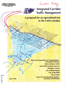
The Minnesota Department of Transportation, Hennepin County, the Cities of Bloomington, Edina, Richfield, and private sector companies propose the Operational Test of an advanced traffic management system called Integrated Corridor Traffic Management (ICTM). The I-494 Corridor was chosen for the proposed test. The initial limits, from east to west, are 34th Avenue South and East Bush Lake Road. The north/south limits include the existing parallel routes formed by 76th-77th Streets on the north and 79th-80th Streets on the south. Implementation of the proposed operational test will occur in four modules spanning a four year period. The approximate cost of each module ranges from $1.5 to $2.5 million. Each module will be evaluated for its effectiveness prior to the implementation of the successive module. An integrated approach is needed to adequately handle current, short-term, and long-term travel demand in the I-494 Corridor. The I-494 Corridor Study found that no realistic I-494 mainline improvement would satisfy forecasted travel demand within the corridor without the development of a parallel arterial system. Studies associated with the preparation of the I-494 Draft EIS corroborated that finding. These same studies found that the average trip length on I-494 is less than two miles long. Redirection of these local/short trips to a convenient, continuous, more efficient parallel arterial will reduce delays, congestion, and the number and seventy of incidents on I-494. The goal of the proposed demonstration of ICTM is to improve the efficiency of traffic movement throughout the I-494 Corridor. This will be achieved by applying a combination of traffic management strategies developed through inter-jurisdictional cooperation and coordination. These strategies will be applied to both the freeway and the adjacent arterial system.

Archeological Monitoring for the Minnesota Trunk Highway 55 Project

Image
Date Created
2002-09
Description
The Louis Berger Group, Inc., has completed archaeological monitoring of Survey Areas 4, 5, and 7 for the Minnesota Trunk Highway 55 project in southeastern Minneapolis, Hennepin County, Minnesota. The work was performed under contract with the Minnesota Department of Transportation (Mn/DOT Agreement No. 79688; S.P. No. 2725-53). The monitoring was done to ensure (a) that no pre-contact occupation or burial archaeological deposits were present in the construction corridor in Survey Areas 4 and 5, (b) that no archaeological deposits associated with the U.S. Army bivouac Camp Coldwater (1820-1821), the civilian Camp Coldwater Settlement (1821-1840), or Dakota use of the area as a burial area were present in Survey Areas 4 and 5, and (c) that no historic burials were present in Survey Area 7, on land reserved for a Protestant cemetery prior to 1886. The work determined that substantial ground disturbance from construction and demolition of buildings for the Veteran's Administration (1925-1988) had destroyed the native soils in much of Survey Area 4 and confirmed that a wetland was present in the area of the four oak trees identified by the Mendota Mdewakanton Group as the site of Dakota interments. Although intact native soil was present in much of Survey Area 5, no archaeological features and only a few artifacts were found that relate to the Camp Coldwater bivouac or civilian settlement. No evidence of a cemetery was identified in Survey Area 7. Intact soils were present on the slope of Morgan's Mound, but the area to the east was almost entirely disturbed by excavation and filling, probably for construction of current Minnesota C.S.A.H. 62. Survey and evaluation of a wooded area at the east side of Survey Area 5 resulted in the recovery of many artifacts that date to the Camp Coldwater Settlement period and may be associated with either the Antoine Pepin or the Le Rage household. However, this site (designated Site 21HE309) did not include any structural features and the site area is significantly disturbed by logging, borrowing, and erosion. The site, which measures 42 meters north to south by 21 meters east to west, lacks the archaeological integrity necessary to be eligible for inclusion in the National Register of Historic Places.

TH 610/TH 252 Draft Environmental Impact Statement

Image
Date Created
1981-04
Description
This Draft EIS documents the impacts associated with the implementation of TH 610/TH 252 in the northwestern suburbs of the Minneapolis-St. Paul Metropolitan area. The proposed project is intended to provide additional capacity across the Mississippi River to alleviate existing and projected congestion and safety problems. The environmental consequences of the project alternatives, including the No-Build alternative, are documented and compared such that a preferred alternative may be selected.

Graeser Park fountain and beehive, c. 1940

Image
Date Created
1940
Description
This photograph shows the fountain and the beehive fireplace at Graeser Park Historic Roadside Property circa 1940. The fountain is no longer in operation.

Graeser Park rock garden, c. 1940

Image
Date Created
1940
Description
This photograph shows the newly built Graeser Park circa 1940. The stone picnic table, fountain, and the beehive fireplace can be seen in the photo.