MnDOT Implementation of Complete Streets Policy

Image
Date Created
2014-01
Description
Minnesota Statutes 174.75 defines complete streets as the planning, scoping, design, implementation, operation and maintenance of roads in order to reasonably address the safety and accessibility needs of users of all ages and abilities. Complete streets considers the needs of motorists, pedestrians, transit users and vehicles, bicyclists, and commercial and emergency vehicles moving along and across roads, intersections and crossings. It does this in a manner that is sensitive to the local context and recognizes that needs vary in urban, suburban and rural settings.

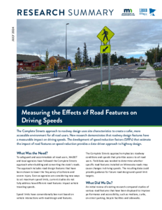
Complete Streets Speed Impacts

Image
Date Created
2024-06
Report Number
2024-13
Description
Recently, speed management practices have shifted away from an historical focus on the 85th percentile speed toward a safe systems approach that is focused on promoting safer speeds in all roadway environments through a combination of thoughtful, equitable, context-appropriate roadway design, appropriate speed-limit setting, targeted education, outreach campaigns, and enforcement. This includes the incorporation of a Complete Streets approach to roadway design, which uses cross-sectional characteristics that reduce speeds and create a more accommodating environment for people biking and walking. This study aims to inform this design process by advancing our understanding of how drivers adjust their speeds based on changes in the posted speed limit and other contextual factors related to the roadway environment. Field data were collected from 19 highway corridors across Minnesota using handheld lidar guns to track drivers' operating speeds as they transitioned from high-speed rural highways to lower-speed rural and suburban communities. The study results in the estimation of a series of speed reduction factors (SRF), which detail the impacts of various site-specific characteristics on travel speeds. Various features are shown to serve as effective speed-control measures, such as single-lane roundabouts, which reduced speeds by about 7 mph. Speeds were also lower on segments that included two-way, left-turn lanes (0.7mph), depressed medians (1.2 mph), and raised medians (3.1 mph). The results also show that drivers typically begin reducing their speeds approximately 800 ft upstream of posted speed limit signs and continue to reduce their speeds to a distance 400 ft beyond the sign location. Ultimately, this study will allow for a more proactive and data-driven approach to highway design that considers the needs of all users.

Safety Impacts of Implementing Complete Streets

Image
Date Created
2014
Report Number
2013-31TS
Description
This Technical Summary pertains to the LRRB-produced Report 2013-31, “Implications of Modifying State Aid Standards: Urban Construction or Reconstruction to Accommodate Various Roadway Users,” published December 2013.

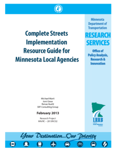
Complete Streets Implementation Resource Guide for Minnesota Local Agencies

Image
Date Created
2013
Report Number
2013RIC02
Description
There is National movement and legislation regarding Complete Streets with significance for impacts on Local Agencies. The Minnesota Local Road Research Board funded the development of this “Complete Streets Implementation Resource Guide” that is intended as a guide to local agencies interested in developing their own policy. This resource includes an overview on Complete Streets, a brief synthesis of local and national practices, an understanding of the various terms and definitions, guidance on implementation and a summary of agencies in MN with Complete Streets with complete streets policies or other guidance and projects in MN related to Complete Streets.

Assessing the Economic Impact and Health Effects of Bicycling in Minnesota

Image
Date Created
2016
Report Number
2016-36
Description
This project estimated the economic impact of the bicycling industry and events in Minnesota, estimated bicycling infrastructure use across the state, and assessed the health effects of bicycling in the Twin Cities metropolitan area (TCMA). A survey of bicycling-related manufacturers, wholesalers, retailers, non-profit and advocacy groups found the industry produced a total of $779.9 million of economic activity in 2014. Using data from multiple sources, The number of bicycle trips in Minnesota was estimated to be between 75.2 and 96 million annually. The TCMA accounts for 69%-72% of the total number of trips and miles traveled in Minnesota. Bicycling events, including races, non-race rides, fundraising events, mountain bicycling events, high school races, and bicycle tours, produced a total of $14.3 million of economic activity in 2014. All six types of bicycling events mainly attract white, non-Hispanic male participants. "Riding my bicycle" was the most frequently identified reason to attend an event (except for fundraising event participants), and there is a variety of enjoyable attributes that differed across event types. Overall, respondents were satisfied with the events. Bicycle commuting prevents 12 to 61 deaths per year, saving $100 million to $500 million. Bicycle commuting three times per week is also linked to 46% lower odds of metabolic syndrome, 32% lower odds of obesity, and 28% lower odds of hypertension, all of which lower medical costs. Project findings tell a compelling story for the positive effects of bicycling and provide direct evidence that supports the efforts of promoting bicycling-related industry, infrastructure, events, and activities.

Complete Streets from Policy to Project: The Planning and Implementation of Complete Streets at Multiple Scales

Image
Date Created
2013
Report Number
2013-30
Description
Complete streets is emerging as an influential movement in transportation planning, design, and engineering. This guidebook, with accompanying case studies, explores the variety of ways in which complete streets is conceptualized and institutionalized by various jurisdictions. It offers practical and applicable insights for jurisdictions in Minnesota and elsewhere. The research focused on best practices in 11 locations across the nation: Albert Lea, Minnesota; Arlington County, Virginia; Boulder, Colorado; Charlotte, North Carolina; Columbus, Ohio; Dubuque, Iowa; Fargo-Moorhead, North Dakota/Minnesota; Hennepin County, Minnesota; Madison, Wisconsin; New Haven, Connecticut; and Rochester, Minnesota. The guidebook is informed by an analysis of multiple data sources from each jurisdiction. The authors conducted a review of key documents (e.g., plans, policies, design guidelines), site visits, photo documentation, and in-depth interviews with more than 100 key informants. Six best practice areas emerged through the analysis: (1) framing and positioning, (2) institutionalizing complete streets, (3) analysis and evaluation, (4) project delivery and construction, (5) promotion and education, and (6) funding. The six best practice areas are described in detail and illustrated by examples from the case locations. The guidebook concludes with an appendix of complete streets case reports that offer additional details about each of the 11 case jurisdictions.