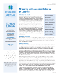
This research summary is part of the final deliverable for Report 2025-22, "Comparison of Compost and Proprietary Soil Amendments for Vegetation Establishment," Published in March 2025.
Post-construction roadside soils often suffer from compaction, low fertility, and poor structure, challenging vegetation establishment and stormwater management. This study evaluates the effectiveness of organic amendments (OAs) and proprietary amendments as alternatives to traditional methods. The study involves greenhouse experiments (pot and mesocosm) and field experiments to evaluate vegetation growth and water quality across different amendment and soil applications. Results show that compost amendments significantly improve vegetation growth, with yard-waste compost outperforming others. Biochar shows early growth potential but requires nutrient supplementation for sustained performance. Proprietary amendments support rapid vegetation establishment, enhanced root density, and reduced nutrient leaching, with Sustane 4-6-4 exhibiting consistent growth across application rates. The field study validates greenhouse findings and shows increased biomass and root density with compost amendments, while proprietary amendments result in high nutrient retention and runoff quality. This study highlights the potential use of OAs and PAs to reduce erosion and support long-term vegetation growth. The findings provide practical guidelines, benefits and implementation steps for managing roadside soils after construction activities.
Laboratory remolded subgrade soil samples have been widely used to study subgrade resilient modulus. But physical conditions, such as moisture content and density, of such specimens may not represent in-situ conditions very well. Therefore, AASHTO and the Long-Term Pavement Performance program (LTPP) have recommended that undisturbed thin-walled tube samples should be used to study subgrade resilient behavior. The Minnesota Department of Transportation (Mn/DOT) is developing mechanistic-empirical pavement design approaches through the Minnesota Road Research project and has realized the importance of resilient modulus in the design approaches. Currently, the Mn/DOT is making an effort to study resilient modulus of unbound pavement materials through laboratory experiments. Under a research project at the Mn/DOT, several thin-walled tube samples of subgrade soil were obtained from six different pavement sections at the Minnesota Road Research project. Repeated loading triaxial tests were conducted on the soil specimens to determine resilient modulus at the Mn/DOT laboratory. Also, some soil properties, such as resistance R-value and plasticity index were obtained. R-value is an indicative value of performance when soil is placed in the subgrade of a road subjected to traffic. Two constitutive models (Uzan-Witczak universal model and the deviator stress model) were applied to describe the resilient modulus. The objective of the research was to compare these two well-known constitutive models in describing subgrade soil resilient behavior and to study effects of material properties on the resilient modulus.
From the specimens tested, the experimental results showed that the universal model described the subgrade resilient modulus slightly better than the deviator stress model and the coefficients in these two constitutive models were found to have correlation to material properties. Also, no well-defined relationships between R-value and the coefficients in the constitutive models were observed from the results of the tested specimens.
Content Note: This is the author’s version of a work that was accepted for publication in the Transportation Research Record: Journal of the Transportation Research Board, Issue Number: 1786, Publisher: Transportation Research Board ISSN: 0361-1981. The final version can be found at https://doi.org/10.3141/1786-03.
On highway construction projects it is necessary to determine moisture contents of soils and aggregates in connection with earthwork, subbase, base, concrete, and bituminous construction. This determination by the present conventional methods is time consuming, and there has been increasing criticism by contractors that tests of this type are causing delays in the progress of their work. Consequently more rapid methods have been sought for making reliable moisture control tests particularly on base materials and embankment soils.
The purpose of this investigation was to determine the accuracy and time saving possibilities of the Calcium Carbide Gas Pressure (CCGP) Moisture Tester when used as a field testing device in comparison with conventional field methods for moisture content determination. This report presents the results of extensive field tests with the instrument. A previous study (Investigation No. 122) had established that moisture contents can be accurately determined with this device under the ideal working conditions of the laboratory.
Moisture testers were placed on 14 field projects selected so that the widest possible range of soil types could be tested. Some base and subbase materials were also tested.
The results of this investigation to date indicate that the stabilometer may be a very useful tool in the evaluation of Minnesota soils and aggregates. However, the method of applying the results of the test to the design of flexible pavements still has to be established. This remaining problem is undoubtedly the most difficult and will be the third phase of Investigation No. 176
This study was originated in 1960 at the request of the Minnesota Local Road Research Board. Its basic objective is to determine a means of backfilling slit-type trenches so that little or no settlement results. In the first four years personnel from the Research Section, Office of Materials, Minnesota Highway Department, collected data by observing trench backfilling during regular construction operations and then measuring the subsequent settlements. In 1964, 1965, and 1966 dummy trenches were excavated and backfilled under more controlled conditions. This work was done by the City of St. Paul and Minnesota Highway Department maintenance forces. All testing was done by Research Section personnel.
In 1963, a progress report titled BACKFILLING TRENCH EXCAVATIONS was published by the Materials and Research Section, Minnesota Department of Highways. Included were general recommendations for street preparation, backfilling, and patching. Also, the effectiveness of various types of compactors was discussed and specific compaction procedures for given soils and traffic conditions were recommended. The results of the controlled backfill studies reported herein have confirmed certain of those recommendations for compaction procedures but have contradicted others. The investigation to date has not satisfied its objective and is being continued.
In the summer of 1969, seventeen dummy trenches were excavated and backfilled using the original A-6 day loam soil. The backfill was compacted to densities from 95.2 to 103.5 percent of AASHO T-99 maximum density. Surface settlements and settlements at depths of 0.7, 2.0, 4.0 and 6.0 ft were measured over a period of 21 months. The settlements were mostly in the 0.04- to 0.08-ft range. Only four settled less than 1/2 in. Seventy percent of the settlement occurred during the first fall and spring after construction. Observed settlement was dominantly in the upper 2 feet of the 6-ft backfill. There was essentially no movement at the bottom of the trench. It is concluded that settlements of approximately 1/2 to 1 in. must be anticipated for trenches with plastic soils even when compacted in relatively thin layers to relatively high densities.
A limited supply of high quality base aggregates in several parts of Minnesota has resulted in a search for a means of improving the physical and strength characteristics of locally available soils and poor quality granular materials. Other states faced with a similar problem have attempted to use soil stabilization as a solution. Common stabilization agents include cement, bituminous materials, sodium and calcium chloride, and sulfite liquor. More recently, several southern states have successfully used lime for stabilization of roadbed materials.
The purpose of this study is to determine the effect of hydrated lime on the physical and strength properties of typical Minnesota soils and aggregates. This first progress report presents the findings of tests conducted during 1961 using hydrated lime and five secondary chemical additives with five fine grained soils
This investigation was included in the research program of the Minnesota Local Road Research Board as a project of special interest to County and Municipal Engineers as well as to Engineers of the Minnesota Highway Department. The project was conducted as a part of the Highway Planning Research Program financed jointly with Federal-Aid funds provided through the United States Department of Commerce, Bureau of Public Roads together with State funds and County and Municipal State-Aid funds.
A laboratory study such as this generally does not provide all the information necessary to determine whether a particular method will prove satisfactory as a construction procedure or to accurately predict field performance. This laboratory study does show that lime has some possibilities as an effective treatment for certain Minnesota soils. However, an experimental field project is needed to establish the suitability of the various laboratory tests as a means for evaluating the adequacy of the soil-lime mixtures for use in road structures.