School start times impact on students walking or biking to school: Safe routes to school

Image
Date Created
2025-04
Report Number
2025-21
Description
Some school districts schedule elementary schools with early start times for various reasons. Such start times sometimes necessitate travel before sunrise during winter months. Intuitively, this could potentially conflict with a desire for increased use of active transportation, e.g. from the Safe Routes To School program, to reduce motor vehicle travel and associated traffic congestion from driving students to school. Since prior literature has identified that parents are concerned about child safety around traffic, it is possible that travel before sunrise (where visibility is reduced) would also be a concern to parents and further discourage active transportation. To answer this question, we conducted a stated preference survey of parents about their child's travel choices, asking parents to rank the importance of various factors including travel before sunrise. Due to concerns about whether stated parental preferences would align with actual behavior, we also conducted a revealed preference survey using StreetLight data on travel to elementary schools. Survey distribution and data collection occurred in February in Minnesota, during a period of late sunrise. Overall, the results from all data analyses are aligned. Early school start times were associated with slightly higher use of active transportation in both stated and revealed travel patterns. Parents ranked travel before sunrise only as a moderate concern behind distance, infrastructure, crossing busy roads, and child's age. We did not find data to conclude that travel before sunrise significantly limits use of active transportation.

Project Summary: Connected Corridor

Image
Date Created
2024-11
Description
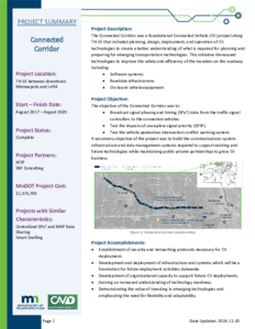
The Connected Corridor was a foundational Connected Vehicle (CV) project along TH-55 that included planning, design, deployment, and operation of CV technologies to create a better understanding of what is required for planning and preparing for emerging transportation technologies. This initiative showcased technologies to improve the safety and efficiency of the travelers on the roadway including: • Software systems. • Roadside infrastructure. • On-board vehicle equipment.

Assessment of Pedestrian Safety and Driver Behavior Near an Automated Vehicle

Image
Date Created
2024-01
Report Number
2024-02
Description
As more automated vehicles enter shared roadways, an essential aspect of automated vehicle (AV) safety is understanding the interactions between these vehicles and other road users. Anecdotal incidents about aggressive following and overtaking behaviors at crosswalks near the Med City Mover (MCM), a low-speed automated shuttle (LSAV) pilot demonstration in Rochester, MN, suggested the need for a scientific study of the behaviors of drivers of manual vehicles near the LSAV. In this report, the research team conducted a series of laboratory and field studies aimed at better understanding the safety relationship between LSAVs and the humans with whom they share the road. Overall, the studies found an increased risk of overtaking and multiple threat passing near the MCM, which may increase the risk of pedestrian-involved crashes, sideswipe crashes, and rear-end crashes. Study findings suggested that poor human-machine interfaces, exceptionally slow vehicle speeds, and resultant large queues behind the MCM contribute to these risks. Improved communication interfaces, speeds more consistent with the surrounding traffic, and smaller queue size will be important factors that AV developers and future pilot demonstrations must consider to better promote pedestrian safety near AVs.

800 MHz Executive Team Report to the 2001 Minnesota Legislature: 800 MHz Statewide Shared Public Safety Radio System

Image
Date Created
2001-02
Description
In the early 1990s, cities, counties and state agencies (primarily in the Twin City Metro area) experienced rapid growth in radio communications. The increased radio traffic on the public safety systems in the Metro created a severe interference problem among existing users. All FCC radio frequencies within the Metro area were in use, which limited system expansion and, in some cases, prohibited growth of radio systems. Interoperability among public safety agencies was hampered and cumbersome. The 1996 Minnesota Legislature funded the construction of a Metro-wide 800 MHz regional backbone system (Chapter 463, Sec.19, Subd. 3) to meet the demands of the Metro area, and provide capacity for local subsystems to join the network. The implementation of this system is in progress and will be operational in 2002. The problems in Metro are not unique to the area. Outstate public safety communications systems are facing many of the same problems that Metro faced ten years ago. For that reason, the 2000 Legislature directed the commissioners of the departments of Administration, Transportation and Public Safety to convene a planning committee to report to the Legislature on a plan for the development of a statewide, shared public safety radio system. The legislation further directed the planning committee to develop a means to include input from representatives of local governments and major system user groups. As a result of the legislative directive, an 800 MHz Executive Team was formed to study and assess the current and future wireless communication requirements, needs and concerns of the local units of government and major system user groups such as the state of Minnesota, the Emergency Medical Services (EMS) community and school districts.

Evaluation of Sand-Filled Barrel Crash Cushions and the Minnesota Bullnose Guardrail

Image
Date Created
1987-01
Description
Sand-filled barrel crash cushions and the Minnesota bullnose guardrail are two types of impact attenuators which protect errant vehicles from collisions with roadside hazards. This study is the result of a need to evaluate the effectiveness of these two devices in reducing the severity of accidents. The emphasis of this study was placed on the safety performance of crash cushions using the National Cooperative Highway Research Program (NCHRP) Report 230 crash testing criteria as guidelines for evaluation. Results of full-scale crash testing of these two devices were used as a model of actual accidents involving these impact attenuators.

Work Zone Safety Advertising Qualitative Evaluation Focus Groups: Final Report

Image
Date Created
2000-03
Description
KEY OBJECTIVES • Evaluate messages and styles of ads used by Construction Office in summer of '99 to promote awareness and safety in work zones. • Determine if use of construction site information is a productive use of airtime. • Assess better ways to convey the importance of driving safely in construction or maintenance work zones. METHODOLOGY: Four focus group interviews were conducted in early March of 2000. Participants were regular users of metro area freeways, with one group being specifically drivers who also traveled north of the Twin Cities at least three times during spring through fall of '99. The latter was to get a comparative base for the site info, which depicted highways 169 and 35E going north, in the previous ad campaign.

Play It Safe

Image
Date Created
1990
Description
The main goals of Play it SAFE are: - to create an awareness of the color orange as a highway sign that means "danger" or "be aware"; - to have students recognize what a work zone is and the possible dangers that lie within it; - to recognize what a traffic control device is; - to encourage individuals to "slow down" within a work zone area; - and to have students recognize the dangers involved in winter driving and the additional dangers in the vicinity of a snowplow. These materials are designed to be used as a supplement to curriculum presently being taught. Each of the exercises is formatted for ease of use. They are summarized by detailing grade level, related subjects, skills needed, duration, group size and setting required.