Culture-Building and Behavior-Change Strategies for The Reduction of Vehicle Miles Traveled

Image
Date Created
2025-04
Report Number
TRS 2501
Description
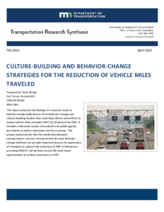
This report presents the findings of a research study to identify transferrable lessons from behavior-change and culture-building models that could help inform state efforts to reduce vehicle miles traveled (VMT) by 20 percent by 2050. It includes a literature review of academic and public agency documents as well as interviews and focus groups. This project demonstrates that the similarities between transportation- and non-transportation-focused behavior-change methods can provide important lessons for application of strategies to support the reduction of VMT in Minnesota, providing MnDOT and partners across the state many opportunities to achieve reductions in VMT.

Twin Cities-St. Cloud-Fargo-Moorhead Corridor Study

Image
Date Created
2025-02
Description
The Minnesota Department of Transportation is pleased to provide this assessment report as required by Minn. Session Law Ch. 68, sec. 112. The purpose of the study was to conduct an analysis and evaluation of options for development of transit and rail service improvements in the corridor between the Minnesota Cities of St. Paul, Minneapolis, Coon Rapids, St. Cloud and Moorhead, and Fargo, North Dakota.

2024 Report on the Corridors of Commerce Program

Date Created
2024-11
Description
This report fulfills the requirements laid out in Minn. Stat. 161.088, subd. 7. A healthy transportation network supports a growing economy by facilitating commerce throughout the state. Transportation investments directly and indirectly foster economic growth with construction jobs and a commerce friendly network of corridors to ship goods and provide mobility to citizens. In 2013, the Minnesota Legislature created the Corridors of Commerce program with the purpose of achieving two major goals: • Provide additional highway capacity on segments where there are currently bottlenecks in the system; and • Improve the movement of freight and reduce barriers to commerce. Since its creation, the eligibility criteria for selecting projects and funding for Corridors of Commerce has changed, yet the goals remain the same.

Trunk Highway 23 St. Cloud Area Transportation Study

Image
Date Created
2003-06
Description
The purpose of the TH 23 study is to determine the roadway improvements in the TH 23 corridor (including parallel corridors) that are needed to serve future traffic demand while minimizing the construction costs, right-of-way costs, environmental impacts, neighborhood impacts, and business impacts. The goal of this study is to develop a long-range concept plan for TH 23 and parallel corridors that would be used as a framework for future improvements in the corridor. It would also serve as a tool for reviewing development plans in the corridor to ensure consistency with the long-range transportation needs.

Statewide Interregional Corridor Study: Executive Summary

Image
Date Created
1999-11
Description
Concern about traffic congestion and loss of mobility on our highways and interstates led Mn/DOT to conduct an Interregional Corridor Study, completed in October 1999. The goal of the Study is to proactively manage the important connections between regional centers in a more cost-effective manner. This goal is consistent with Mn/DOT's strategic objective to develop an interregional corridor system that enhances the economic vitality of the state by providing safe, timely, and efficient movement of people and goods to regional trade centers.

Statewide Interregional Corridor Study

Image
Date Created
1999-11
Description
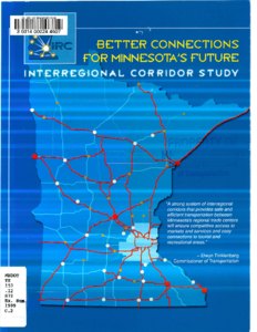
While the 1997 Statewide Transportation Plan supports investments that enhance safety and timely travel between activity centers (regional trade centers), it defined the Interregional Corridor System as the entire 5,200-mile principal arterial system. The entire principal arterial system is too large as the interregional system to allow sufficient focus on the key transportation corridors throughout the state. In addition, previous Plans did not provide guidance on how these corridors should perform from a mobility perspective. The result has been a lack of attention on some major corridors and some inconsistencies between districts on how corridors are managed. As a result, the Minnesota Department of Transportation (Mn/DOT) initiated the Interregional Corridor Study to identify important economic corridors in the state. The goal of the Interregional Corridor System is to maintain safe, timely and efficient transportation services between regional centers. Providing good transportation service to the main activity centers will improve or maintain productivity, reduce transportation costs and support the interdependencies that exist between different areas of the state and between Minnesota and other states and counties.

State Highway 169 Corridor Management Plan: Executive Summary

Image
Date Created
2002-05
Description
In 2000, the Minnesota Department of Transportation (Mn/DOT) identified and adopted a statewide system of arterial roadways that are critical to serving the economic interests of the state. This system, the Interregional Corridor (IRC) System, is comprised of two percent of the roadway miles in the state, but accounts for over 30 percent of the miles traveled. Over the past decade, many of the IRCs have been under increasing congestion and growth pressures. These pressures threaten the ability of Mn/DOT to deliver safe and efficient transportation services both now and in the future. To better address immediate needs and to plan for long-term transportation needs in the most threatened corridors, Mn/DOT developed seven Corridor Management Plans (CMPs). One of the corridors selected for a CMP was the 73-mile section of State Highway 169 from the 1-494 beltway to TH 60 south of Mankato.

State Highway 169 Corridor Management Plan

Image
Date Created
2002-05
Description
The State Highway 169 study began by forming a broad-based Corridor Partnership, comprised of approximately 40 representatives from agencies and communities along the corridor. The Partnership was established to assist Mn/DOT in the development of the Corridor Plan, as well as to assist in ongoing corridor management and implementation. The Partnership had two working groups, a Technical Committee, whose role was to provide technical advice and direction to both Mn/DOT and the Policy Committee, and a Policy Committee, whose role was to review and advise Mn/DOT on major policy issues and corridor strategies. The process used in the development of the TH 169 Corridor Management Plan was intended to create a better understanding of the issues and concerns along the corridor, as well as to develop consensus with Corridor Partners for a long-term vision and action plan that will be implemented over time. The process was also intended to demonstrate how investments and decisions in one part of the corridor can significantly impact the overall performance of the entire corridor and, very importantly, the process emphasized the need for Corridor Partners to build relationships among the group in order to resolve common problems and support each other in realizing the corridor's vision.

I-394 Design Considerations

Image
Date Created
1980
Description
Development of the I-394 highway corridor will affect the communities of Wayzata, Minnetonka, Plymouth, St. Louis Park, Golden Valley and Minneapolis. Providing a positive visual experience on both sides of the highway corridor is important. The images and impressions of the view to the highway from neighborhoods in the area as well as from parks and wildlife areas is of prime concern. The emphasis is placed on enhancement of those communities and neighborhoods along the highway corridor while blending the corridor into the communities. The purpose of this report is to recognize the primary design elements of a freeway corridor and begin considering how these design elements may be organized into a comprehensive transportation solution which integrates the highway corridor into adjacent communities. This study will identify typical design solutions for the public which detail designers of the corridor will take into consideration.

Overview of Planning and Programming in Minnesota

Image
Date Created
2010-10
Description
This document provides an overview of transportation planning and programming for all modes at the Minnesota Department of Transportation, Metropolitan Planning Organizations and Regional Development Commissions throughout Minnesota. The information provided presents a snapshot of current practice in October 2010. The intention of the overview is to provide a resource and reference for Mn/DOT employees and partners to better understand the complexity of transportation planning and programming in Minnesota. Although this overview describes planning and programming for all modes of transportation, it is not intended to be exhaustive and does not describe all aspects of the process in detail.