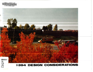
The design development of the I-394 highway corridor will transport the motorist through the communities of Wayzata, Minnetonka, Plymouth, St. Louis Park, Golden Valley and Minneapolis. The images and impressions of these communities will be determined by the view from the freeway, requiring that the designers place appropriate emphasis on the visual enhancement of the various design elements which will occur within the corridor. The visual character of this corridor will provide the motorist with an introduction to the metropolitan area and a strong sense of visual and physical arrival. Design elements throughout the corridor should be considered comprehensively and coordinated so that order and continuity emerge.
This detail design guide will provide highway designers, engineers, landscape architects, technicians and field personnel with the necessary visual and physical design guidelines for the development of this freeway corridor.
Development of the I-394 highway corridor will affect the communities of Wayzata, Minnetonka, Plymouth, St. Louis Park, Golden Valley and Minneapolis. Providing a positive visual experience on both sides of the highway corridor is important. The images and impressions of the view to the highway from neighborhoods in the area as well as from parks and wildlife areas is of prime concern. The emphasis is placed on enhancement of those communities and neighborhoods along the highway corridor while blending the corridor into the communities.
The purpose of this report is to recognize the primary design elements of a freeway corridor and begin considering how these design elements may be organized into a comprehensive transportation solution which integrates the highway corridor into adjacent communities. This study will identify typical design solutions for the public which detail designers of the corridor will take into consideration.
The Minnesota Department of Transportation (Mn/DOT) has recently completed the eleven-mile Interstate 394 Transportation System which has been under construction since 1984. A Grand Opening ceremony was held in October, 1992. The I-394 Transportation System is designed to maximize incentives for High Occupancy Vehicles (HOVs) which include buses, carpools and vanpools. The key components of this transportation system are:
• Three miles of reversible HOV lanes.
• Eight miles of concurrent flow HOV diamond lanes.
• Three parking garages in downtown Minneapolis which have direct access to/from I-394, reduced parking fees for carpoolers, and transit stations.
• Three transit transfer stations.
• Seven park-and-ride lots.
• Expanded express and timed-transfer local bus service.
• Rideshare matching, public information, enforcement and other programs supporting and encouraging HOV use.
• Automated traffic management system.
• Eight HOV meter bypass lanes.
• Skyways connecting the downtown Minneapolis parking garages to each other and ultimately to the downtown Minneapolis skyway system.
The purpose of this report is to evaluate the operation and effectiveness of the I-394 Interim High Occupancy Vehicle (HOV) lane between initiation of mainline construction and the completion of major portions of I-394 (November 1986 to January 1990). It is a companion report to "I-394 Interim HOV Lane: A Case Study, Phase I Report" which was published in October 1987. The Phase I report covered the period between November 1985 and October 1986, which was the first year of operation of the I-394 Interim HOV lane.
It is appropriate to complete the Phase II evaluation at this time because the first section of the permanent reversible HOV lane between downtown Minneapolis and T.H. 100 will open in the summer of 1990. A Phase III evaluation is recommended following the completion of other HOV lane segments with periodic follow-up evaluations after completion of the entire 1-394 Transportation System.
This summary is divided into five parts. The first part highlights the findings in the use of I-394 from 1992 to 1994. Part Two summarizes the performance of the I-394 system according to the objectives and measures set forth in the 1984 Transportation System Management Plan (TSMP). Part Three is a discussion of the important operations issues for the I-394 corridor. Part Four discusses the need for ongoing data collection. Part Five presents the conclusions of the case study research.
I-394 will be built by the Minnesota Department of Transportation (MN/DOT) along the existing alignment of Trunk Highway 12 (T.H. 12) between 1985 and 1990. I-394 will pass through the cities of Minnetonka, St. Louis Park, Golden Valley and Minneapolis. The construction of the highway will be funded with 90 percent Interstate funds.
The HOV lane design concept which will be built along I-394 is a proven concept which is on the cutting edge of advances in highway design in the United States. Highways must become more productive within the physical constraints of fully developed urban areas. Both the Shirley Highway in Washington, D.C. and the San Bernadino Freeway in California are excellent examples of the effective use of HOV lanes to increase highway productivity. Both facilities carry approximately three times as many people per lane in HOV lanes as they do in mixed traffic lanes. I-394 is the first attempt to implement this technology on a major highway in the Twin Cities area. I-394 is unique in that three parking garages are being built as a part of the Interstate facility. Free or low cost parking in these garages will be one of the major incentives for carpooling on I-394.
The timed-transfer bus service concept proposed for the I-394 service area is also a state-of-the-art transit service concept which has not yet been implemented on a major scale in the Twin Cities Area. This service concept has the advantage of greatly increasing cross-town travel opportunities while improving overall system productivity (cost per passenger mile).
The strategic location of I-394 between the western suburbs and downtown Minneapolis make it a very attractive commuter route. Capacity rather than demand will dictate traffic volumes on I-394 just as it does on Highway 12 today. The High Occupancy Vehicle (HOV) express lanes are a very important means of greatly increasing the people carrying capacity of the highway within its physical constraints. The transportation system to be implemented in the I-394 corridor is illustrated in Figure 4. The system provides both services and facilities to encourage ridesharing for the commuter trip from home to work:
The Minnesota Department of Transportation is searching for ways to maximize the use of transportation alternatives among single occupant vehicle drivers to (a) reduce traffic congestion, (b) improve the efficiency and sustainability of the regional transportation system, and (c) improve the livability of the Twin Cities region and the competitive advantage of its economy. Multi-Modal Alternative Transportation Study is designed to measure the potential for change in mode shift behavior in a corridor that has alternative infrastructure in place (1-394).
The purposes of this study are to:
1. Identify incentives, services and facilities that have the greatest likelihood of changing commuting behavior (use of alternative modes of transportation at least one day per week).
2. Identify groups of individuals for whom the alternative modes have realistic appeal.
3. Establish baseline data from which to measure trends in this corridor over the course of deploying promotional programs (incentives and marketing).
4. Investigate the appeal of alternative modes within a health context.
5. Determine the amount of telecommuting that is taking place and the types of workers who telecommute.
The Minnesota Department of Transportation (Mn/DOT) and agency partners at the Metropolitan Council and the Federal Highway Administration (FHWA) have undertaken this planning process to develop a long-term vision for the 1-394 MnPASS project to help achieve optimal performance of the corridor for the next thirty years.
For purposes of this study, the I-394 Corridor is generally defined as the area east of Wayzata, south of Highway 55, west of downtown Minneapolis and north of Highway 7. The study area is depicted in the graphic below and follows the boundaries created by Transportation Analysis Zones (TAZ) that were used as sources of information on trips and demographics.
The results of this study will be used to guide investments in corridor facilities and services by transportation authorities and to assist communities adjacent to the corridor in making compatible land use decisions so that the integrity and operational performance of the corridor can be maintained for the future. Funding for this planning study was partially provided by the U.S. Department of Transportation through the FHWA under provisions of the Value Pricing Pilot Program as authorized under ISTEA, TEA-21 and SAFETEA-LU.