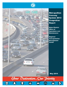
The annual Congestion Study is a geographical illustration of the metropolitan freeway system's traffic performance. It portrays time and areas of congested traffic flow during the A.M. and P .M. peak periods.
Congested areas are determined from data gathered by traffic management sensor arrays. The data, five-minute volumes and lane occupancy values, provide input into the determination of the average five-minute running speeds per lane.
This report is a summary of the time a freeway operates below 45 miles per hour. Freeway system field observations indicate that under this condition, shock waves develop in the traffic flow. Our working definition of congestion is then traffic flow below 45 miles per hour. The data summary compares the traffic during the month of October in each of the years. This is done to minimize the effects of construction and maintenance-induced congestion and to account for school-induced traffic loads. The study uses 1993 as a base year, the first year the report was done.
This report presents data using multiple-choice questionnaires to learn how drivers respond to traffic information in the form of advisory messages. Two experiments, comprising 112 participants, were conducted using the same technique and yielding similar results. The traffic information messages presented to participants varied in three respects; quantitativeness of information, imperativeness of advice, and timeliness of information. Two additional factors were examined; the amount of traffic congestion stated to be directly observable on the route and the stated accuracy of messages received in the past.
Results obtained from the questionnaires indicate that the structure of the traffic message did influence the driver behavior. The propensity to depart from the planned route ahead of schedule was greater when respondents had; few exit options remaining, been told traffic levels were high, received accurate traffic information in the past, and had received messages which contained quantitative and/or imperative information.
Traffic controllers with this knowledge of driver behavior could act to further reduce trip times and congestion by using the control tools currently available to them. The major conclusion we can draw from this study is that when possible and appropriate, advisory messages should contain accurate, timely, quantitative and imperative information.
The purpose of this project, "Trucks and Twin Cities Traffic Management," is to identify strategies that will reduce congestion for trucks traveling within and through the Twin Cities. The planning and development of most highway facilities focuses on the general needs of the majority of traffic in the traffic stream. However, the performance, function, and purpose of heavy trucks are dissimilar to those of the majority of the vehicles in the traffic stream. It is for this reason that the National Cooperative Highway Research synthesis report 314 identified a number of improvements that state transportation agencies have implemented, or are planning to implement, that focus on the unique needs of trucks to better accommodate truck-borne freight traffic. Additionally, to help reduce delays and congestion a number of urban areas have conducted studies of the unique issues trucks face. The study first identified an exhaustive list of potentially feasible strategies and then through iterative steps narrowed these down to the most promising. Five strategies were ultimately selected. The report focuses on issues related to the five strategies and their implementation.
Dynamically priced High Occupancy Toll (HOT) lanes have been recently added to the traffic operations arsenal in an attempt to preserve infrastructure investment in the future by maintaining a control on demand. This study focuses on the operational and design features of HOT lanes. HOT lanes' mobility and safety are contingent on the design of zones ("gates") that drivers use to merge in or out of the facility. Existing methodologies for the design of access zones are limited to engineering judgment or studies that take into consideration undersized amount of observations. Case in point is the fact that the design philosophes between the two HOT facilities in Minnesota are diametrically opposed. Specifically, the I-394 freeway, the first dynamically priced HOT lane, was designed with a closed access philosophy, meaning that for the greater length of the roadway access to the HOT lane is restricted with only specific short-length sections where access is allowed. In contrast I-35W, the second HOT corridor, was designed with an open access philosophy where lane changes between the HOT and the GPLs are allowed everywhere except for a few specific locations. This contradiction generated questions as to effect each case has on safety and mobility. This study presents an assessment of safety and mobility on the two facilities as they operate today and highlights the issues present on either design.
The Integrated Corridor Management (ICM) approach has drawn increasingly more attention in recent years because it is believed to be a promising tool to mitigate urban traffic congestion. In this project, a maximum flow based control model was first developed to handle oversaturated traffic conditions at signalized arterials. Based on the arterial control model, an integrated control model was proposed to manage network congestion. Through diversion control, the model aims to fully utilize the available capacity along parallel routes. The impact of the diversion traffic is considered, especially for signalized arterials, so that traffic congestion on the diversion route can be reduced or eliminated by proper adjustment of signal timings. This model does not rely on time-dependent traffic demand as model inputs and it is ready to be implemented at typical parallel traffic corridors where the standard detection system is available. The performance of the proposed model was tested using microscopic traffic simulation in the I-394 and TH 55 corridor in Minneapolis, Minnesota. The results indicate that the proposed model can significantly reduce network congestion.
In this project, researchers sent mail surveys to commercial vehicle operators (CVOs)--for-hire carriers and private fleet operations-in the Twin Cities to determine their use of congestion information and their ability to attach specific values to congestion costs. The project also assessed the ability of CVOs to avoid congestion.
The report presents survey findings. Despite the fact that a vast majority of respondents indicated congestion information would be useful, CVOs do not rely currently on available congestion information to any significant extent. The reasons may include lack of awareness and/or an inability of CVOs to effectively use the form and content of the information. For-hire carriers also are not well-equipped to estimate congestion costs with any degree of confidence. This results from apparently inadequate costing systems and/or technology to capture costs at the vehicle level. Further, respondents said that they had very little flexibility to adjust schedules to avoid congestion. Also, shippers without private fleets feel significantly less strongly about congestion as a problem than their counterparts with such fleets. Thus carriers maybe constrained in their ability to use congestion information. The report also contains a demographic profile of CVOs operating in the Twin Cities and recommendations for further research.
Traffic flow study of the Miller Hill corridor on Highway 194 between Arlington Avenue and Haines Road, the most heavily traveled and congested roadway in the Duluth area. The study includes preliminary data collection using a non-intrusive Remote Traffic Microwave Sensor (RTMS), traffic flow modeling, traffic simulation and development of an efficient traffic signa l light timing plan. The author develops a reasonably accurate model to estimate traffic flow, which is used in association with the RTMS and a database system to conduct real-time traffic simulations. Results of the simulation were used to develop a traffic-signal optimization plan with Synchro 5.0 software. Discussion of problems faced and how improvements could be made through further research. The author concludes with a proposal that recommends the adoption of the newly developed signal-timing plan to alleviate the traffic congestion on the Miller Hill corridor.
"What would it take to build our way out of congestion in the Twin Cities?" was the question posed by researchers five years ago. This previous study solved a roads-only network design problem (NDP) for the Twin Cities of Minnesota. Building on that work, another network design problem is examined for the Twin Cities metropolitan area of 3 million, to examine the tradeoff between demand side reductions and the limited access capacity expansion necessary to achieve desired levels of service. The problem is simplified by pre-determining a mode split, which allows for incorporating decreasing demand directly as an input rather than in the model formulation. The problem is solved using Sequential Linear Expansion (SLIE), a modified method of successive averages (MSA). Computation time for the large network is decreased to a reasonable length using another modification, the MSA with decreasing re-initialization (MSADR). A typical personal computer can solve this large-sized problem within 24 hours. For forecasted travel demand for 2030, it was found that if the number of trips were reduced by 20%, lanemiles needed to achieve LOS D decreases by up to 43%.
The Minnesota Department of Transportation (Mn/DOT) collaborates with Team Transit to increase transit use and improve the efficiency of the metropolitan highway system by allowing buses to use the designated shoulders to bypass traffic congestion. In this project, researchers evaluated the costs and benefits associated with bus-only shoulder projects and concluded the following:
• Measured travel time savings on the bus-only shoulders are highly variable, but savings run as high as nine minutes per trip under snowy conditions.
• 60 percent of respondents indicated that, on a typical day, the use of shoulders by buses resulted in travel time savings of about 5 minutes.
• Bus regard bus-only shoulders as a use and positive addition to their commute trip.
• The number of accidents directly relating to bus use of shoulders is very low.
• The 10-foot minimum requirement for bus-only shoulders is marginally adequate.
The study concluded that the use of the bus-only shoulder concept should continue, with an evaluation of additional projects on a case-by-case basis. The report also presents additional suggestions regarding guidelines and criteria for projects.
This report is unpublished. 15 copies were produced and distributed.
The Tipping Point – What COVID-19 Travel Reduction Tells Us About Effective Congestion Relief uses observed data collected before and during the COVID-19 pandemic in the Twin Cities metropolitan area to answer a question with important implications for highway investment planning and travel demand management: At what level of vehicle miles traveled (VMT) does congestion significantly decline or disappear? The study pursues this question through a series of statistical analyses identifying inflection points in the relationship between regional VMT and congestion. The study also looks at the relationship between VMT and congestion at the corridor level to assess the sensitivity of congestion on specific roadways to changes in travel demand. This analysis categorizes Twin Cities freeways based on congestion frequency, highlighting the corridors expected to become congestion free as VMT declines and the corridors expected to remain congested.
The Metropolitan Freeway System Congestion Report is prepared annually by the Regional Transportation Management Center (RTMC) to document those segments of the freeway system that experience recurring congestion. This report is prepared for these purposes:
• Identification of locations that are over capacity
• Project planning
• Resource allocation (e.g., RTMC equipment and incident management planning)
• Construction zone planning
• Department performance measures reporting
The Metropolitan Freeway System Congestion Report is prepared annually to document those segments of the freeway system that
experience recurring congestion. This report is prepared for these purposes:
- Identification of locations that are under capacity
- Project planning
- Resource allocation (e.g., RTMC equipment, incident management planning)
- Construction zone planning
- Department performance measures
These are the appendices for the 2005 MnPASS System Study Final Report. The contents are:
Appendix A. Capital Cost Estimates
Appendix B. Details of Travel Demand Estimates
Appendix C. Sensitivity Analysis of Cost Recovery Ratio to Discount Rate
Appendix D. Segment Evaluation Summary
The Minnesota Department of Transportation (Mn/DOT) conducted this study of the I-94 corridor between downtown Minneapolis and downtown St. Paul. Mn/DOT's purpose was to identify potential improvements to the physical facilities and traffic operations that existed prior to the I-35W bridge collapse in August 2007, while establishing an overall vision for potential improvements in the I-94 corridor, including improvements for both general traffic operations and transit services. Recommendations that result from this study were focused on meeting or exceeding the established project goals:
- Better utilize existing infrastructure investments;
- Preserve or enhance advantages for transit and carpoolers, as well as for general traffic;
- Provide a congestion-free choice for Single Occupancy Vehicles (SOV);
- Preserve or enhance corridor safety.
The goals and objectives for evaluating ramp meter effectiveness in the Twin Cities Metropolitan Region were designed to investigate system performance and public acceptance of the new ramp metering strategy. Implemented following the shutdown - as described in Section 1.0, page 1-2. The Phase II evaluation goals include:
1. To evaluate whether the benefits of the new ramp metering strategy outweigh the impacts and associated costs;
2. To identify the impacts of the new ramp metering strategy at selected surface streets; and
3. To evaluate the impacts of the new metering strategy on freeway-to-freeway ramps.
For each of the broad evaluation goals, several detailed evaluation objectives were identified. These evaluation objectives provided the framework for conducting the evaluation. Table 2.1 presents the evaluation objectives as they relate to each of the evaluation goals. The following sections describe in greater detail the tasks required to fulfill each of the evaluation's three main goals and associated objectives.
Traffic congestion is the largest problem on Twin Cities metropolitan area freeways. National estimates indicate that congestion causes 65 percent of all accidents. Congestion reduces the mobility of all freeway users and the overall economic efficiency of the freeway. Congestion also increases fuel consumption and air pollutant emissions.
In order to reduce congestion, the Minnesota Department of Transportation (Mn/DOT) is aggressively developing freeway traffic management and incident management systems. These systems have relatively low capital costs, can be implemented quickly, and are very effective in reducing much of the congestion and accidents.
The Highway Helper program is a key component of Mn/DOT's expanding traffic management systems. The program is designed to reduce traffic congestion on the most congested metropolitan area freeway segments. Highway Helpers accomplish
this mission by patrolling freeway routes searching for, responding to, and removing congestion-causing incidents.
During the first five years of operation, the Highway Helper program averaged 8,100 motorists assists per year. In March 1993, the management of the program was transferred to Mn/DOT's Freeway Operations Section located at the Traffic Management Center (TMC) and the hours of operations were expanded. Since then, the number of motorists assisted each year has increased to an average of 11,200 per year.
Public support for the Highway Helper program has been outstanding. Perception tracking surveys indicate that approximately 76 percent of the public surveyed are aware of the program and 87 percent of those people think that the program is a good use of state tax money. Over 1,500 response cards or letters have been received from the motorists assisted by Highway Helpers and 96 percent of these motorists rated the Highway Helper program as excellent.
Traffic congestion is the biggest problem on Twin Cities metro area freeways. It causes 65% of accidents, reduces the mobility of freeway users, affects the economic efficiency of the freeways, and substantially increases fuel consumption and air pollutant emissions. To reduce congestion, the Minnesota Department of Transportation (Mn/DOT) is aggressively developing freeway traffic and incident management systems. These systems have low capital costs, can be implemented quickly, and are very effective in reducing congestion and accidents.
The Highway Helper Program is a key component of Mn/DOTs expanding traffic management program. Highway Helpers patrol freeway routes in heavy duty pickup trucks searching for and responding to incidents. They reduce traffic delays through prompt clearing of incidents from the metropolitan freeway system and provide aid to stranded motorists.
During the first five years of operation, the Highway Helper Program averaged over 8,100 motorists assisted per year. Management of the program was transferred from Metro Division Maintenance to the Traffic Management Center (TMC) in March 1993. Since that time, this number has increased 58% to almost 12,800 motorists assisted per year. The increase is due primarily to expanded hours of service. There is nearly unanimous motorist support for the program reflected in the 900 response cards or letters received each year. Ninety four percent of the motorists assisted by Highway Helpers are either very satisfied or extremely satisfied with the service. Twenty five percent of these motorists recommend that Mn/DOT expand the service by adding more trucks and covering additional miles.
This report presents an overview of the program.
As has been the situation in other major metropolitan areas, the recurring peak hour congestion problem has illustrated a need for freeway operation beyond the signing, striping, police and maintenance activity. It is now also apparent that surveillance and control measures are but a part of a necessary Traffic Management System incorporating the full range of detection, observation and response capabilities.
This report documents the activities of the Minnesota Highway Department in the area of freeway surveillance and control and how these activities are in keeping with an ultimate Traffic Management System for the seven county Twin Cities Metropolitan Area. Current projects are located on I-35E in St. Paul/Ramsey County and I-35W & 1-94 in the Minneapolis/Hennepin County area (Figure 1).
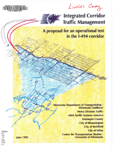
The Minnesota Department of Transportation, Hennepin County, the Cities of Bloomington, Edina, Richfield, and private sector companies propose the Operational Test of an advanced traffic management system called Integrated Corridor Traffic Management (ICTM). The I-494 Corridor was chosen for the proposed test. The initial limits, from east to west, are 34th Avenue South and East Bush Lake Road. The north/south limits include the existing parallel routes formed by 76th-77th Streets on the north and 79th-80th Streets on the south.
Implementation of the proposed operational test will occur in four modules spanning a four year period. The approximate cost of each module ranges from $1.5 to $2.5 million. Each module will be evaluated for its effectiveness prior to the implementation of the successive module.
An integrated approach is needed to adequately handle current, short-term, and long-term travel demand in the I-494 Corridor. The I-494 Corridor Study found that no realistic I-494 mainline improvement would satisfy forecasted travel demand within the corridor without the development of a parallel arterial system. Studies associated with the preparation of the I-494 Draft EIS corroborated that finding. These same studies found that the average trip length on I-494 is less than two miles long. Redirection of these local/short trips to a convenient, continuous, more efficient parallel arterial will reduce delays, congestion, and the number and seventy of incidents on I-494.
The goal of the proposed demonstration of ICTM is to improve the efficiency of traffic movement throughout the I-494 Corridor. This will be achieved by applying a combination of traffic management strategies developed through inter-jurisdictional cooperation and coordination. These strategies will be applied to both the freeway and the adjacent arterial system.
The Metropolitan Freeway System Congestion Report is prepared annually to document those segments of the freeway system that experience recurring congestion. This report is prepared for these purposes:
• Identification of locations that are under capacity
• Project planning
• Resource allocation (e.g., RTMC equipment, incident management planning)
• Construction zone planning
• Department performance measures
The Metropolitan Freeway System Congestion Report is prepared annually to document those segments of the freeway system that
experience recurring congestion. This report is prepared for these purposes:
- Identification of locations that are under capacity
- Project planning
- Resource allocation (e.g., RTMC equipment, incident management planning)
- Construction zone planning
- Department performance measures
The primary objectives of this study are to determine:
- peoples' perception of the level of traffic that exists today,
- individuals' level of tolerance for the congestion they experience,
- if the level of traffic has an impact on individuals' lives,
- the primary reasons behind individuals' decisions to move their primary residence,
- what effect, if any, individuals' perceptions of traffic have on driving behavior, and to
- compare results between 1998 and 2007 tracking periods to identify meaningful differences, if any.
Our region is facing rapid congestion growth and extreme delays. With a projected 37% population increase in the Twin Cities metropolitan area from 2000 to 2030, the ability to deal with chronic congestion, reduced air quality, and overall quality of life issues is critical to our collective well being. Continued inadequate funding for transportation and transit will create serious economic and societal costs for all of us. MnPASS offers a tool to deal with rapidly mounting congestion problems.
The most significant finding of the Steering Committee is that a variably priced, interconnected system of MnPASS toll lanes would be an effective tool to manage congestion and provide transit advantages in the Metropolitan Area. Mn/DOT and the Metropolitan Council should actively pursue this. While the Steering Committee believes such a system should be integrated into future transportation plans, our consensus is that such a system should not displace projects currently underway at Mn/DOT.
If such an interconnected system is constructed, the State of Minnesota rather than the private sector should make the necessary public investment to launch such a system, and the revenues generated should contribute to construction and operating costs - something no traditional Minnesota roadway has done in the past.
In order to gain a broad perspective of incident management, Mn/DOT gathered key members of local agencies and organizations commonly involved in incident-handling activities. From a collaborative examination of the issues, Mn/DOT hoped to arrive at new directions and innovative solutions to heavy truck incident management and, further, to the entire incident-related congestion problem.