Displaying results 1 - 7 of 7
Results per page
10
25
50

Archival of Traffic Data: Phase II

Image
Date Created
1998-12
Report Number
1999-28
Description
Traffic centers gather information from traffic sensors at regular intervals, but storing the data for future analysis becomes an issue. This report details work to improve the speed and effectiveness of traffic databases. In this project phase, researchers redesigned the data model based on the previous phase's data model and decreased the storage requirements by one-third. Researchers developed a web-based Graphical User Interface (GUI) for users to specify the query of interest; the outcome of the performance tuning gave users reasonable response time. The beneficiaries of this effective database would include the driving public, traffic engineers, and researchers, who are generally not familiar with the query language used in the database management system. This report summarizes the detailed reference, such as benchmark query, sample data, table schema, conversion code, and other information.

Contraflow Transportation Network Reconfiguration for Evacuation Route Planning

Image
Date Created
2006
Report Number
2006-21
Description
Given a transportation network having source nodes with evacuees and destination nodes, we want to find a contraflow network configuration, i.e., ideal direction for each edge, to minimize evacuation time. Contraflow is considered a potential remedy to reduce congestion during evacuations in the context of homeland security and natural disasters (e.g., hurricanes). This problem is computationally challenging because of the very large search space and the expensive calculation of evacuation time on a given network. To our knowledge, this paper presents the first macroscopic approaches for the solution of contraflow network reconfiguration incorporating road capacity constraints, multiple sources, congestion factor, and scalability. We formally define the contraflow problem based on graph theory and provide a framework of computational structure to classify our approaches. A Greedy heuristic is designed to produce high quality solutions with significant performance. A Bottleneck Relief heuristic is developed to deal with large numbers of evacuees. We evaluate the proposed approaches both analytically and experimentally using real world datasets. Experimental results show that our contraflow approaches can reduce evacuation time by 40% or more.

Storage and Access Methods for Advanced Traveler Information Systems

Image
Date Created
1996-04
Report Number
96-26
Description
This report examines the use of the Connectivity-Clustered Access Method (CCAM) to improve network operations. The expected I/O cost for many network operations can be reduced by maximizing the Weighted Connectivity Residue Ratio (WCRR), i.e., the chance that a pair of connected nodes that are more likely to be accessed together are allocated to a common page of the file. An access method for general networks that uses connectivity clustering, CCAM supports the operations of insert, delete, create, and find, as well as the new operations, get-A-successor and get-successors, which retrieve one or all successors of a node to facilitate aggregate computations on networks. The nodes of the network are assigned to disk pages via a graph partitioning approach to maximize the WCRR. CCAM includes methods for static clustering, as well as dynamic incremental reclustering, to maintain high WCRR in the face of updates, without incurring high overheads. The report also describes possible modifications to improve the WCRR that can be achieved by existing spatial access methods. Experiments with network computations on the Minneapolis road map show that CCAM outperforms existing access methods, even though the proposed modifications also substantially improve the performance of existing spatial access methods.

A traffic data management system for navigation, collision detection, and incident detection: final report

Image
Date Created
1994
Report Number
94-22
Description
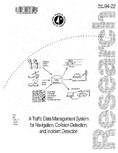
A traffic data management system is an integral part of an IVHS (Intelligent Vehicle Highway System), which obtains information from road sensors, city maps and event schedules, and generates information to drivers, traffic controllers and researchers. We extend the relational database with abstract data types and triggers to model traffic information in a relational database. Abstract data types are needed to efficiently model spatial and temporal information, since they may create inefficiencies in traditional databases. We use monotonic continuous functions to map the object to disk addresses to save disk space and computation time. A model of spatial data is created to efficiently process moving objects. For IVHS databases, we provide schema that have the relevant abstract data types. We also have a large sample of the relations needed to model IVHS data. Several interesting queries are presented to show the power of the model. Triggers are defined, using rule-definition mechanisms to represent incident detection and warning systems. An efficient physical model with the MoBiLe access method is provided.

Trace driven driving simulation: towards integration of external lab with simulator and the integrated study of microscopic and macroscopic problems in IVHS : emulation of the I-394 external laboratory in a driving environment: final report

Image
Date Created
1994
Report Number
94-23
Description
The research in traffic flow and safety has proceeded on two different tracks. The traffic flow research has focused on macroscopic aspects and aggregate behavior, while safety research has focused on the traveller's microscopic view of the transportation system. This dichotomy of research methodology has made it difficult to study many issues in intelligent vehicle highway systems in an integrated manner. In this project, we explore ways of facilitating research on problems which require integration of the two views of the transportation systems. In particular, we explore headup displays for conveying aggregate traffic information and exceptions to the drivers. We evaluate text based and graphic map based displays with fixed orientation as well as egocentric orientation. Our studies indicate that graphic displays are more effective than text based displays for the assimilation of information by drivers. Furthermore, our studies suggest that an egocentric map display allows drivers to assimilate and process information faster than a fixed orientation display.

Report on Programmatic Evaluation at the Human Factors Research Laboratory

Image
Date Created
1995-03
Report Number
95-13
Description
This report summarizes human factors research for IVHS/ITS projects and focuses on the following five tasks: The comparative evaluation of ITS in-vehicle information prototypes. This experiment compares drivers' reaction to the use of three forms of in-vehicle information systems in driving simulation: the Delco prototype, the Volvo Dynaguide prototype, and a procedure that presented a voice generation information system. It includes recommendations for in-vehicle device designs. The evaluation of driver response to an in-vehicle ITS technology. This experiment evaluated drivers' responses to information presented on an in-vehicle ITS. Geographic databases for IVHS management. This work extends the concept of relational databases to model traffic information in an approach that uses abstract data types and triggers. The improvement of simulation facilities. This task describes the acquisition and installation of equipment and software to improve simulation capabilities at the Human Factors Research Laboratory and its impact on research efforts. In-vehicle collision avoidance warning systems for IVHS. This experiment examined the effects of presenting warnings of vehicle proximity on turn decisions.

Multimedia Information Presentation in Smart Cars and Highways

Image
Date Created
1995-05
Report Number
95-25
Description
An essential component of Advanced Traveler Information Systems, in-vehicle route displays give drivers route options, alert them to incidents, and show their present location. In this report, researchers explore multimedia interfaces to present route information to travelers using map, text, and auditory-based representations, focusing on developing portable multimedia interfaces. The report concludes that the graphical user interface (GUI) for display of route information is satisfactory for small road maps. The GUI also proved useful for visually checking map quality. The Tcl/Tk toolkit, in which the GUI was developed, is a reasonable tool to design an interface because it is portable to many platforms. Speech generation tools are not yet robust enough for use with large maps. Future work could include extending the GUI to provide a hierarchical display for large roadmaps, extending the amount of information conveyed to the user, and improving speech generation techniques.