Displaying results 1 - 7 of 7
Results per page
10
25
50

Interstate 35E Study Phase 1 Report: Incorporating the Project Development Report and Preliminary Location Report Required by the Mn/DOT Action Plan

Image
Date Created
1979
Description
One of the few uncompleted parts of the interstate highway system in Minnesota is the St. Paul link, a five-mile segment between the 1-35E (Lexington) bridge and downtown St. Paul. Construction of the 1-35E link in the Pleasant Avenue Corridor began in the mid-1960s, but was halted in 1972 in legal action brought by the City of St. Paul, neighborhood organizations and individuals. A consultant was retained in 1972 to conduct an environmental evaluation study. The resulting Butler 1-35E Report issued in 1975 reaffirmed the Pleasant Avenue Corridor for a freeway with recommended design modifications.

Minnesota Public Transit-Human Services Coordination Study

Image
Date Created
2006-03
Description
The Minnesota Public Transit and Human Services Coordination Study, a state initiative undertaken by the Minnesota Department of Transportation in cooperation with the Metropolitan Council, undertook this project to establish a planning Framework to educate public transit and human service transportation stakeholders at the local level (e.g., organizations responsible for transporting agency clients, students, and the general public) about the benefits of coordinating public transit and human service transportation, identify transit industry Best Practices in public transit and human service transportation coordination activities, and develop a statewide action plan for improving transportation coordination.

LRT/Land Use Coordination: The Land Use Element of the Regional Transit Board's Light Rail Transit Coordination

Image
Date Created
1990-08
Description
The purpose of this report is to provide a planning framework to ensure adequate coordination between the development of a light rail transit (LRT) system and land use related activities. This framework can be utilized at different stages of LRT development to take advantage of development opportunities or, if desired, to preserve stable neighborhoods and businesses in the vicinity of LRT lines. This report serves as information and guidance to cities in the Twin Cities Metropolitan Area, which are ultimately responsible for land use related decisions, and to the Regional Transit Board (RTB) and regional rail authorities which are primarily responsible for the development of an LRT system in the Twin Cities

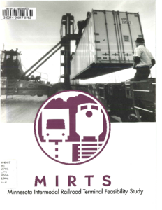
Minnesota Intermodal Railroad Terminal Feasibility Study (MIRTS)

Image
Date Created
1996
Description
The Minnesota Intermodal Railroad Terminal Study (MIRTS) was formed in June of 1993 to evaluate the need for new or expanded intermodal terminal facilities in the Twin Cities metropolitan area. MIRTS is a public/private partnership originally made up of the Burlington Northern Santa Fe (BNSF), Canadian Pacific Railway (CP), the Minnesota Department of Transportation (Mn/DOT) and the Metropolitan (Met) Council. Union Pacific Railroad (UP) joined later in anticipation of extending their service to the Twin Cities area. MIRTS completed a study in February 1995; concluding that the region needs to more than double its intermodal terminal capacity. This would require construction of new facilities. MIRTS then investigated the feasibility of creating a joint facility large enough to meet the Twin Cities' intermodal shipping needs to the year 2012. In November 1995, MIRTS identified one area in Cottage Grove and two in Rosemount as viable locations for a new multi-user, intermodal terminal in the metro area. MIRTS consulted with staff from the three local railroads and its eighteen-member advisory committee - made up of local manufacturers, shippers, municipalities, academics, transportation professionals and potential users - before making these selections. This report establishes a model for terminal investment and examines the terminal's possible effect upon local communities and the public highway and private railroad infrastructure.

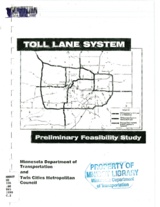
Toll Lane System: Preliminary Feasibility Study

Image
Date Created
1998-01
Description
This study is a direct follow-on from the results of a Congestion/Road Pricing Study conducted by Wilbur Smith Associates (WSA), in association with SRF Consulting Group (SRF) in 1997. The Congestion/Road Pricing Study evaluated the potential impacts of and public opinion related to a congestion road pricing program in the Minneapolis-St. Paul area and of a statewide vehicle mileage tax. The study concluded with identification of key issues regarding possible road pricing. As a result of the Congestion/Road Pricing Study, a proposal for adding capacity through high occupancy toll lanes was made. This new study, Toll Lane System Preliminary Feasibility Study, was commissioned to evaluate the impacts of a series of added-capacity lanes on most freeways in the Minneapolis-St. Paul metropolitan area. An extensive market research program was also carried out to identify public reaction to the policy and operational aspects of pricing on new capacity in order to define a Communications Plan for Mn/DOT's ongoing Congestion Relief Toll Lane System Initiative. The region's plan is to promote transit and carpooling by adding lanes on the area's most congested freeways. The added capacity lanes are intended for the use of high-occupancy vehicles (HOVs) free of charge. To make maximum use of excess capacity in the HOV lanes, single occupancy vehicles (SOVs) would be allowed into the new lanes if they paid a toll. The basic system studied is based on Mn/DOT's Transportation System Plan (TSP) and Metropolitan's Council Transportation Policy Plan (TPP). Additional segments were added to the base scenario to test various concepts and alternative configurations. This study analyzed the anticipated use of the toll lanes under a variety of rates, the effect of the additional capacity on adjacent "free" lanes, and operational implications of such a system, and estimated system costs and revenues. In addition, a ramp meter bypass buy-in program was also analyzed.