Displaying results 1 - 10 of 13
Results per page
10
25
50

I-35W & Mississippi River Bridge Anti-Icing Project

Image
Creator
Date Created
2001
Report Number
2001-22
Description
A bridge that spans the Mississippi River on U.S. Interstate 35W in Minneapolis, Minnesota has been fitted with a computerized system that sprays potassium acetate, the anti-icing chemical selected, on the bridge deck when data from sensors and a Road Weather Information System determine that hazardous winter driving conditions are imminent. The I-35W bridge (9340) was a candidate for this high-tech treatment due to the high incidence of winter traffic crashes on the bridge. The bridge is more susceptible to "black ice" and slippery conditions because of moisture from the Mississippi River's St. Anthony Falls, nearby power plants and industrial facilities, and of the high volume of traffic on the bridge. (Year 2000 average daily traffic is approximately 139,000 vehicles.) The formation of "black ice" is due to the combination of extreme cold and heavy vehicle exhaust from congestion on the bridge. In addition to traffic safety, the anti-icing system also contributes to sustainability, because the chemical used is environmentally less toxic and corrosive than sodium chloride, which traditionally has been used. This paper describes the anti-icing system and its operational test results.

Traffic Flow and Road User Impacts of the Collapse of the I-35W Bridge over the Mississippi River

Image
Date Created
2010
Report Number
2010-21
Description
Major network disruptions have significant impacts on local travelers. A good understanding of behavioral reactions to such incidents is crucial for traffic mitigation, management, and planning. Existing research on such topics is limited. The collapse of the I-35W Mississippi River Bridge (August 1, 2007) abruptly disrupted habitual routes of about 14,000 daily trips and forced even more travelers to adapt their travel pattern to evolving network conditions. The opening of the replacement bridge on November 18, 2008 generated another disturbance (this time predictable) on the network. Such "natural" experiments provide unique opportunities for behavioral studies. This study focuses on the traffic and behavioral reactions to both bridge collapse and bridge reopening and contributes to general knowledge by identifying unique patterns following different events. Three types of data collection efforts have been conducted during the appropriate frame of reference (i.e. before vs. after bridge reconstruction): 1) GPS tracking data and associated user surveys, 2) paper and internet-based survey data gauging travel behavior in the post-bridge reconstruction phase, and 3) aggregate data relating to freeway and arterial traffic flows, traffic control, and transit ridership. Differences in reactions to planned versus unplanned events were revealed. Changes in travel cost were evaluated and their temporal and spatial patterns were analyzed. This report concludes with thorough discussions of findings from this study and policy implications.

Development of a Queue Warning System Utilizing ATM Infrastructure System Development and Field Testing

Image
Date Created
2017
Report Number
2017-20
Description
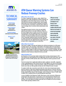
MnDOT has already deployed an extensive infrastructure for Active Traffic Management (ATM) on I-35W and I-94 with plans to expand on other segments of the Twin Cities freeway network. The ATM system includes intelligent lane control signals (ILCS) spaced every half mile over every lane to warn motorists of incidents or hazards on the roadway ahead. This project developed two separate systems that can identify lane-specific shockwave or queuing conditions on the freeway and use existing ILCS to warn motorists upstream for rear-end collision prevention. The two systems were field tested at two locations in the ATM equipped network that have a high frequency of rear-end collisions. These locations experience significantly different traffic-flow conditions; allowing for the development and testing of twodifferent approaches to the same problem. The I-94 westbound segment in downtown Minneapolis is known for its high crash rate due torapidly evolving shockwaves while the I-35W southbound segment north of the TH-62 interchange experiences longstanding queues extending into the freeway mainline. The Minnesota Traffic Observatory developed the I-94 Queue Warning system while the University of Michigan; under contract; developed the I-35W system. Prior to the I-94 installation; based on data collected in 2013; there were 11.9 crashes per VMT and 111.8 near crashes per VMT. In the first three months of the system's deployment; event frequency reduced to 9.34 crashes per million vehicle miles of travel (MVMT) and 51.8 near crashes per MVMT; a 22% decrease in crashes and a 54% decrease in nearcrashes. The I-35W system did not undergo a similarly thorough evaluation; but for most of the lane segments involved; it showed that queue warning messages help reduce the speed variance near the queue locations and the speed difference between upstream and downstream locations. This also implicated a satisfactory level of compliance rate from travelers.

Safety Impacts of the I-35W Improvements Done Under Minnesota's Urban Partnership Agreement (UPA) Project

Image
Date Created
2017
Report Number
2017-22
Description
As part of an Urban Partnership Agreement project; the Minnesota Department of Transportation added lanes and began operating a priced dynamic shoulder lane (PDSL) on parts of Interstate 35W. Following the opening of these improvements; the frequency of rear-end crashes increased in certain sections; especially in the PDSL region. The object of this study was to determine if these increases were direct effects of the improvements or were due to changes in traffic conditions. Logistic regression analyses which controlled for changes in traffic conditions indicated no direct effect on the likelihood of rear-end crashes due to operation of the PDSL; the observed change in crash frequency was explained by the change in traffic conditions. This study also found evidence for a nonlinear relationship between a proxy for traffic density; lane occupancy; and the probability of a rear-end crash occurring during an hour. In several sections crashes were most likely when lane occupancies were approximately 20%-30%; and crash likelihood tended to decrease for lane occupancies below and above this range.

Evaluation of Highway Advisory Radio in the I-35W Traffic Management Network

Image
Date Created
1979-03
Description
In June, 1977 the Federal Highway Administration (FHWA) and Mn/DOT signed a Memorandum of Understanding agreeing Eo cooperate in a demonstration of the use of highway advisory radio (HAR) as a part of the I-35W traffic management system. FHWA agreed to furnish the major system components and provide technical Information and consultation to Mn/DOT, and Mn/DOT agreed to install, operate and evaluate the system. This work was accomplished under the terms of the Minnesota Basic Agreement (DOT-FH-ll-8565) as Task Order No. 5, The system was developed on a 1.26 mile (2.03 Km) section of I-35W in Richfield, and became operational in December, 1977. The purpose of this report is to present detailed information on the HAR system, and to document the results of the evaluation study.

Freeway Traffic Management: A Review of Minnesota's Experience, 1969-1973

Image
Date Created
1973-05
Description
As has been the situation in other major metropolitan areas, the recurring peak hour congestion problem has illustrated a need for freeway operation beyond the signing, striping, police and maintenance activity. It is now also apparent that surveillance and control measures are but a part of a necessary Traffic Management System incorporating the full range of detection, observation and response capabilities. This report documents the activities of the Minnesota Highway Department in the area of freeway surveillance and control and how these activities are in keeping with an ultimate Traffic Management System for the seven county Twin Cities Metropolitan Area. Current projects are located on I-35E in St. Paul/Ramsey County and I-35W & 1-94 in the Minneapolis/Hennepin County area (Figure 1).

I-35W Incident Management and Impact of Incidents on Freeway Operations

Image
Date Created
1982-01
Description
The I-35W traffic management system has been in operation for over seven years. The purpose of the project was to implement and evaluate the Bus-on-Metered Freeway System. A number of reports have been published documenting the design details, system hardware and software, system operation and evaluation of the Bus-on-Metered Freeway concept. A listing of these reports is presented in the Appendix. Appendix also includes a list of reports dealing with incident detection and/or incidents impact on capacity. One of the specific objectives within the system framework was to quickly detect incidents occurring on the freeway and provide information to the appropriate response agency so that freeway capacity reducing and hazard causing incidents could be removed as soon as possible. The purpose of this study is twofold: first, available incident records accumulated on the I-35W freeway traffic management system will be analyzed to develop a comprehensive view of the types and quantities of incidents that have occurred. Second, the incident data base and companion volume and occupancy data will be used to determine the impact of "typical" incidents and the impact of the total incident problem. Included in the report is an analysis of incident types detected, mode of incident detection, duration of incidents, and incident response activities.