The Economic Impact of a Freeway Bypassing Luverne, Adrian and Worthington

Image
Date Created
1970-04
Description
The general introduction to this report is designed to analyze the developments in highway transportation as they relate to the profound economic changes that have taken place in Minnesota and in our nation in the last forty years. This is incorporated into the analysis of the characteristics common to Luverne, Adrian, and Worthington, the specific subjects of the report. The communities will then be analyzed separately, with the impact of Interstate Freeway 90 serving as the primary focus of the report. The changing traffic and land use patterns in the communities, as a result of the advent of 1-90, will be utilized to examine various developments in Luverne, Adrian, and Worthington during the 1960's. Thus, in analyzing the impact of 1-90 on these communities, the major emphasis will be on past and present economic conditions as a guide for possible future developments.

Minnesota Bike Map West

Image
Date Created
2001
Description
The front side of "Minnesota Bike Map West" contains the map of the southwestern quadrant of the state, from Elmore to Genola, a legend, a small map of native vegetation in the state, and an article about bicycling safety and security. The back side contains the map of the northwestern quadrant of the state, from Genola to St. Vincent, and a legend. MnDOT's bikeway maps serve as a reference guide illustrating major historical and cultural points of interest in Minnesota, public park lands and facilities, equipment, and safety information. They also depict road analyses for bicycle travel, location of paved road shoulders and off-road bikeways, and controlled access roads where bicycles are prohibited. There are 54 maps in the Statewide Series (1979-1983), 4 maps in the Statewide Quadrant Series (1986-1993), and 2 maps in the Metro Series (1989). Legislatively mandated, these maps were prepared as convenient guides to help bicyclists select their routes. Each map is unique and signifies a historical reference to the state of bicycle facilities at the time of publication.

Explore Minnesota Bikeways: Southwest

Image
Date Created
1993
Description
The front side of "Explore Minnesota Bikeways: Southwest" contains: inset maps of Willmar, Alexandria, Fairmont, Worthington, Hutchinson, Marshall, and New Ulm; an illustration of Highland Farms, Pipestone and Prairie routes; and bicycling safety tips. The back contains the larger bikeways map and a legend. MnDOT's bikeway maps serve as a reference guide illustrating major historical and cultural points of interest in Minnesota, public park lands and facilities, equipment, and safety information. They also depict road analyses for bicycle travel, location of paved road shoulders and off-road bikeways, and controlled access roads where bicycles are prohibited. There are 54 maps in the Statewide Series (1979-1983), 4 maps in the Statewide Quadrant Series (1986-1993), and 2 maps in the Metro Series (1989). Legislatively mandated, these maps were prepared as convenient guides to help bicyclists select their routes. Each map is unique and signifies a historical reference to the state of bicycle facilities at the time of publication.

Transportation-based classifications of Minnesota's counties and metropolitan statistical area tracts using measures from the 1990 Census of Population and Housing: Final Report

Image
Date Created
1994
Report Number
94-25
Description
Census measures are used to classify Minnesota counties and metropolitan area census tracts according to demographic, journey-to-work, and mobility characteristics in 1990. Counties differ regarding scores calculated with respect to Population Mass-reflecting measures such as numbers of persons, of commuters, and of vehicles available for personal use; and a general Commuting tendency-reflecting proportions of commuters traveling more than 30 minutes, average commute time, and average number of vehicles per household. Three other basic characteristics of counties-average Socioeconomic Status of residents, degree of Mobility Impairment of residents; and Solo Commuting tendency-provide scores further differentiating counties. County scores are used to group Minnesota's 87 counties into six diverse clusters: 1) Hennepin (Minneapolis); 2) Ramsey (St. Paul); 3) Anoka and Dakota (Twin Cities suburbs); 4) St. Louis (Duluth); Olmsted (Rochester), Stears (St. Cloud), Washington (Twin Cities); and 6) all others. The second analysis examines 833 census tracts in the Minnesota's five MSAs, classifying them with the procedures used for counties. Resulting classifications illustrate that relationships between travel activity and socioeconomic characteristics vary considerably for different metropolitan contexts. As a demonstration of potentially useful methods applied to census data for Minnesota, the study provided results. On other grounds, its value is more limited.

Minnesota Bikeways: Map 40 - Southwest Minnesota, Worthington to Pipestone

Image
Date Created
1981
Description
The front side of "Minnesota Bikeways: Map 40 - Southwest Minnesota" contains a legend of signs and symbols, the larger bikeways map, and the map index. The back side contains: a list of county, municipal, state, and national parks and state rest areas; a "potpourri" article; a checklist of touring supplies with a diagram of where to put supplies on a bike; and inset maps of Luverne, Fulda, Worthington, Slayton, and Pipestone. MnDOT's bikeway maps serve as a reference guide illustrating major historical and cultural points of interest in Minnesota, public park lands and facilities, equipment, and safety information. They also depict road analyses for bicycle travel, location of paved road shoulders and off-road bikeways, and controlled access roads where bicycles are prohibited. There are 54 maps in the Statewide Series (1979-1983), 4 maps in the Statewide Quadrant Series (1986-1993), and 2 maps in the Metro Series (1989). Legislatively mandated, these maps were prepared as convenient guides to help bicyclists select their routes. Each map is unique and signifies a historical reference to the state of bicycle facilities at the time of publication.

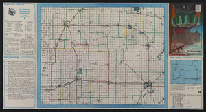
Accident Analysis of Significant Crash Rates for Low to Very Low Volume Roadways in 10 Minnesota Counties

Image
Date Created
2004
Report Number
2004-22
Description
Traffic data from 1996 and continuing through the first half of 2001 were analyzed for roadways with low to very low traffic volumes in ten southwestern Minnesota counties resulting in information about the causes of crashes. Three sets of analysis were carried out on the database. First was a descriptive analysis of the data to determine the general frequency rates of accidents. A second identified dangerous roadways. Counting the number of crashes on specific roadways and dividing this number by the average daily traffic (ADT) on a roadway generated crash rates for those roadways, including county state aid highways (CSAHs), county highways, and township roads. Roadways with the highest 5% were considered significantly dangerous. Crash rates were generated for specific locations. This method identified 15 dangerous locations, nine on CSAHs, three on county highways, and two on township roads. There were only 235 cases where no improper driving was indicated. The remaining 1,554 cases suggested that driver error was the major cause. The most likely factor in causing an accident on a highway with an ADT of less than 400 is a crash involving an animal. Road design factors such as number of lanes and the speed limit seem to be the factors related to these accidents.