Development and demonstration of a novel Red Light Running Warning System using connected v2i technology

Image
Date Created
2024-12
Report Number
2024-33
Description
Running red traffic signals is a major cause of traffic collisions and resulting injuries and fatalities. Despite extensive prior work on systems to reduce red light violations, they continue to be a major problem in practice, partly because existing systems suffer from the flaw of providing the same guidance to all drivers. As a result, some violations are avoided, but other drivers ignore or respond inappropriately to red light running systems, resulting in safety issues overall. We present a novel method of providing accurate warnings to individual drivers to avoid the broad guidance approach of most existing systems. Recognizing if a driver will run red lights is highly dependent on signal phase and timing, traffic conditions along the road, and individual driver behavior, the proposed warning system contains three parts: a traffic prediction algorithm, an individual warning signal optimizer, and a driver warning display. The traffic prediction algorithm predicts future traffic states along the road towards the signalized intersections using the latest traffic conditions obtained through vehicle-to-vehicle and vehicle-to-infrastructure communications. Then, an optimization problem is formulated to compute the optimal warning signal based on predicted traffic states and driver reaction model. Finally, the optimal warning signal is shown on the display screen to advise driver on how much braking is needed to avoid running the red light. The results of both simulated driving scenarios and real-world road tests show that the proposed system provides more effective and accurate warning signals to drivers, helping them avoid running red lights.

Project Summary: Dynamic Flashing Yellow Arrow Phase Mode Selection

Image
Date Created
2024-11
Description
This project focused on utilizing high-resolution signal data, crash data, and volume data to analyze safety impacts associated with the three left-turn phasing modes that flashing yellow arrows could operate in and determine when the various modes should operate. The three modes were as follows: • Protected only. • Protected-permissive. • Permissive only. The project team needed to analyze the data in two different methods to better understand the results. The analysis was completed for 9 scenarios with different combinations of: • Speed (Low / High) • Lateral Offset (Positive / Negative) • Left-Turn Lane (Single / Dual) The result of this project was a methodology that could be used for future analysis and incorporation of safety data into FYA operations decisions. No specific updates were made to the existing FYA phase mode decision spreadsheet.

Project Summary: Smart Snelling

Image
Date Created
2024-11
Description
The Smart Snelling project was comprised of two main components: • Testing a third-party application to provide users signal phasing and timing (SPaT) information. • Testing snowplow signal priority. MnDOT and Ramsey County installed connected vehicle technology equipment at 16 intersections owned by MnDOT and Ramsey County. The project tested the equipment’s ability to provide snowplow signal priority by communicating with the onboard unit on the plow truck. The project also tested the “TravelSafely” mobile phone application’s capabilities to provide real-time information accurately and effectively about signal phasing and timing to inform travelers of phase changes, red-light running, and presence of pedestrians/cyclists.

Project Summary: Real-Time Integration of Arrow Board Messages into Traveler Information Systems

Image
Date Created
2024-11
Description
Many DOTs struggle with real-time information being relayed to their users in situations that involve lane closures. Due to the variability in location and duration, real-time integration of arrow board messages into traveler information systems became an item of interest for MnDOT to provide up-to-date data to travelers. This project involved: • Deployment of an integrated ITS solution to report on the location and operational status of arrow boards in real time to MnDOT's Regional Transportation Management Center (RTMC) systems. • Integration of the arrow board status information with the MnDOT Intelligent Roadway Information System (IRIS) to alert RTMC operators of lane closures who could then add messaging to nearby dynamic message signs. • Integration of the arrow board status information with the MnDOT Condition Acquisition and Reporting System (CARS) which provided real-time updates to the traveler information system. The pilot project involved 20 arrow boards equipped with the status monitoring unit to test displaying real-time information to travelers related to stationary and mobile lane closures.

Project Summary: Variable Pedestrian Clearance Interval (VPCI)

Image
Date Created
2024-11
Description
The Variable Pedestrian Clearance Interval (VPCI) project consisted of deploying, testing, and analyzing the results of installing video at an intersection to extend the Flashing Don't Walk (FDW) interval as needed when pedestrians were still located within the crosswalk. To complete this project, the project team: • Installed pedestrian detection equipment. • Reviewed an initial round of testing data to find gaps in the system data. • Determined a new path forward after identifying the data gaps. • Tested additional pedestrian detection equipment. • Utilized ATSPM data to verify the outcome of the pilot.

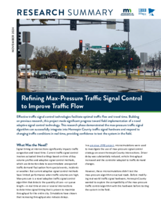
Toward implementation of max-pressure control on Minnesota roads: Phase 2

Image
Date Created
2024-10
Report Number
2024-26
Description
Max-pressure (MP) traffic signal control is a new and innovative control algorithm that uses upstream and downstream vehicle counts to determine signal timing that maximizes throughput. While this method has been extensively tested in simulation, it has not yet been tested on actual traffic signals in the US. To close this gap, this report presents the results of the development of a hardware-in-the-loop traffic signal testbed where microsimulation is used to simulate realistic traffic conditions, and the MP algorithm is used to control the signal display using a traffic controller (Q-Free MaxTime controller). The hardware-in-the-loop results demonstrate that MP can be safely deployed on North American traffic signal control hardware.