Project Summary: MnDOT Traffic Camera Maximizer

Image
Date Created
2024-11
Description
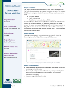
This project involved the implementation of a Traffic Camera Maximizer (TCM).The Traffic Camera Maximizer was proposed to broaden the reach of the following MnDOT assets to improve situational awareness of driving conditions across the state: • 511 public website • Traffic public website • Road Weather Information System (RWIS) cameras To achieve the goals, the project was split into two portions. The first task was to improve the usability of the public 511 website for both desktop and mobile devices. The second task involved highlighting traffic and RWIS cameras within the 511 platform where slowdowns or inclement weather could be automatically detected, and the calculated delay would be displayed on 511. This could improve quality of real-time information.

Project Summary: Real-Time Integration of Arrow Board Messages into Traveler Information Systems

Image
Date Created
2024-11
Description
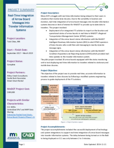
Many DOTs struggle with real-time information being relayed to their users in situations that involve lane closures. Due to the variability in location and duration, real-time integration of arrow board messages into traveler information systems became an item of interest for MnDOT to provide up-to-date data to travelers. This project involved: • Deployment of an integrated ITS solution to report on the location and operational status of arrow boards in real time to MnDOT's Regional Transportation Management Center (RTMC) systems. • Integration of the arrow board status information with the MnDOT Intelligent Roadway Information System (IRIS) to alert RTMC operators of lane closures who could then add messaging to nearby dynamic message signs. • Integration of the arrow board status information with the MnDOT Condition Acquisition and Reporting System (CARS) which provided real-time updates to the traveler information system. The pilot project involved 20 arrow boards equipped with the status monitoring unit to test displaying real-time information to travelers related to stationary and mobile lane closures.

Implementation of Inductive Loop Signature Technology for Vehicle Classification Counts

Image
Date Created
2024-12
Report Number
2024-29
Description
This study evaluates recent technology that uses inductive loop detectors, traditionally used for collecting traffic volume and speed data, to provide vehicle classification data by examining the high-resolution signature produced when a vehicle passes over the sensor. The project aims to verify the accuracy of the new classification system, collect additional heavy vehicle data to help improve system accuracy, and familiarize MnDOT staff with the technology through training and the development of a field deployment manual. Through collaboration with MnDOT and the technology vendor CLR Analytics, Inc., the VSign vehicle classification system has been installed at five sites in Minnesota with preexisting loop detection systems. The final sites are representative of MnDOT facilities, feature a mix of heavy vehicle traffic, and provide accessibility for deployment staff. Data from the VSign system was compared with manually verified ground-truth data collected from video under both the Federal Highway Administration (FHWA) and Highway Performance Monitoring System (HPMS) classification schemes. The system demonstrated high accuracy for passenger vehicles but varying accuracy for different classes of heavy vehicles, though performance improved under the HPMS classification scheme. The VSign system was also evaluated against the video-based iTHEIA™ system at one site, which VSign outperformed in both classification accuracy and detection rate. The results suggested that the VSign system was more effective at locations where vehicles maintained consistent speeds and were centered in the lane due to the negative effects of variations in speed and lateral position on the consistency of vehicle signatures read by the detector.

Field Test of Monitoring of Urban Vehicle Operations Using Non-intrusive Technologies

Image
Date Created
1997-05
Description
This report documents the activities and results of a 2-year test of non-intrusive traffic detection technologies. Non-intrusive technologies are defined as data collection methods that can be done without intruding into the roadway for installation. Non-intrusive devices have the advantage of not disrupting traffic flow or exposing field personnel to dangerous conditions. While there is potential for new technologies to replace the traditional methods of data collection, such as inductive loop detectors and road tubes, there are many questions regarding their performance. This report provides practitioners with useful information about the performance of non-intrusive technologies and specific devices within each technology. Seventeen devices representing eight different technologies were evaluated in varying environmental and traffic conditions. The following technologies were tested: passive infrared, active infrared, magnetic, radar, doppler microwave, pulse ultrasonic, passive acoustic, and video. Testing was done at both freeway and intersection locations. Emphasis was placed on urban traffic conditions, such as heavy congestion, and locations that typify temporary counting locations, such as 48-hour or peak hour counts. The evaluation also focused on the ease of system setup and use, general system reliability, and system flexibility.

Trunk Highway 7 Corridor: ITS Concept Study

Image
Creator
Date Created
1999-05
Description
This document serves as a guide for the potential future design and deployment of an integrated Intelligent Transportation System along TH 7 from Hutchinson to the Twin Cities in Minnesota. The document presents a conceptual plan including a strategy for ITS deployment as recommended by the TH 7 Technical Committee. The concept study was performed to identify opportunities to apply advanced technology to address unresolved problems and needs from proposed physical roadway improvements scheduled along TH 7 over the next several years. A key goal of this study was to identify advanced technology that could cooperatively be applied to enhance transportation management and traveler information capabilities in order to increase safety and efficiency of the transportation system along the TH 7 Corridor.

Trilogy Operational Test: Final Report

Image
Date Created
1998
Description
The Trilogy project was an Intelligent Transportation System (FTS) demonstration of the broadcast\ of freeway system traveler information to both commercial and commuter drivers over a 25-mile (40.3 km) radius of the Twin Cities Metropolitan Area. In this project, real-time freeway system operating conditions, particularly incidents and traffic congestion, were monitored at the Minnesota Department of Transportation (Mn/DOT) Traffic Management Center (TMC). This information was broadcast to a fleet of test vehicles with dashboard mounted display screens. Two different systems were used to broadcast traveler information. The first system, Dynaguide 2.0, utilized the Radio Broadcast Data System (RBDS) - Traffic Message Channel; and the second system, Dynaguide 3.0, utilized the Seiko High Speed Data System (HSDS) to transmit messages to in-vehicle receivers. Dynaguide 2.0 provided the user with information on incidents, planned events, and traffic congestion via icons and text messages generated by operators at the TMC. In comparison, Dynaguide 3.0 provided real-time color coded freeway link speed data and ramp metering conditions generated from the traffic management system detection sensors in addition to the information generated by the TMC operators. Both devices also had the capability to display traffic condition test messages.

Sail 2 Evaluation

Image
Date Created
2007-01
Description
In 1998, the Minnesota Department of Transportation (Mn/DOT) conducted a project originally named Metro Computer Aided Dispatch/Automatic Vehicle Location (CAD/AVL) project. It was than changed to what it is known today - Safety with Automated Intelligent Locator (SAIL). The purpose of this project was to test CAD software and AVL technology in the Twin Cites metro area. This was an operational test that ran from March 19, 1999 to February 26, 2000. Six maintenance vehicles were equipped with portable mobile data terminals (MDT) for the test. The test, at that time, was used to determine the feasibility of AVL technology for maintenance activities in the metro area. The benefits of this project were real-time information for improving decision-making, recording information for after storm playback and analysis, reducing paper work, allowing operator to respond and send messages when it is safe, and provide information for verification of route completion. The SAIL 2 project is an extension of SAIL 1 to further assess the application of AVL systems for gaining value in overall snow fighting techniques, decision support systems, and area-wide highway maintenance issues for winter and summer operations by deployment of fully functional AVL systems. AVL systems were installed on 60 snow removal/highway maintenance vehicles within several Mn/DOT districts in the State of Minnesota. The project is unique from other AVL projects because of the design and planning for integration with Mn/DOT's existing resource management systems.

The Minnesota Guidestar Program: Executive Summary

Image
Date Created
1992-05
Description
This Executive Summary is prepared for the Commissioner of the Minnesota Department of Transportation (Mn/DOT) to provide an overview of the Guidestar IVHS management study final report. The work in this study was performed by Castle Rock Consultants (CRC) in association with Farradyne Systems, Inc., Edwards and Kelcey, Inc. and Media Management Corporation. The final report is presented in four volumes, as follows: - Volume I: IVHS Background Resources; - Volume II: Guidestar Strategic Plan; - Volume III: Assessment of Public/Private Partnership and Investment Opportunities; - Volume IV: Organizational Recommendations.

Minnesota Guidestar Strategic Plan

Image
Date Created
1991-12
Description
This report presents details of a recommended Guidestar strategic plan for the State of Minnesota. It outlines a series of projects and activities proposed for Minnesota in the field of intelligent vehicle-highway systems (IVHS). The strategic plan set out in this report covers short-term activities for the period from the present to 1995; medium-term plans up to the year 2000; and considers some possible long-term ventures into the next century. The report has been prepared by the Castle Rock Consultants (CRC) study team for Minnesota Department of Transportation (Mn/DOT) and the Guidestar partners within the IVHS Management Study.